Archive for May, 2009

Galveston and the Three Little Pigs

Sunday, May 24th, 2009

Click for Galveston, Texas Forecast

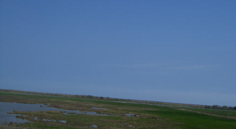
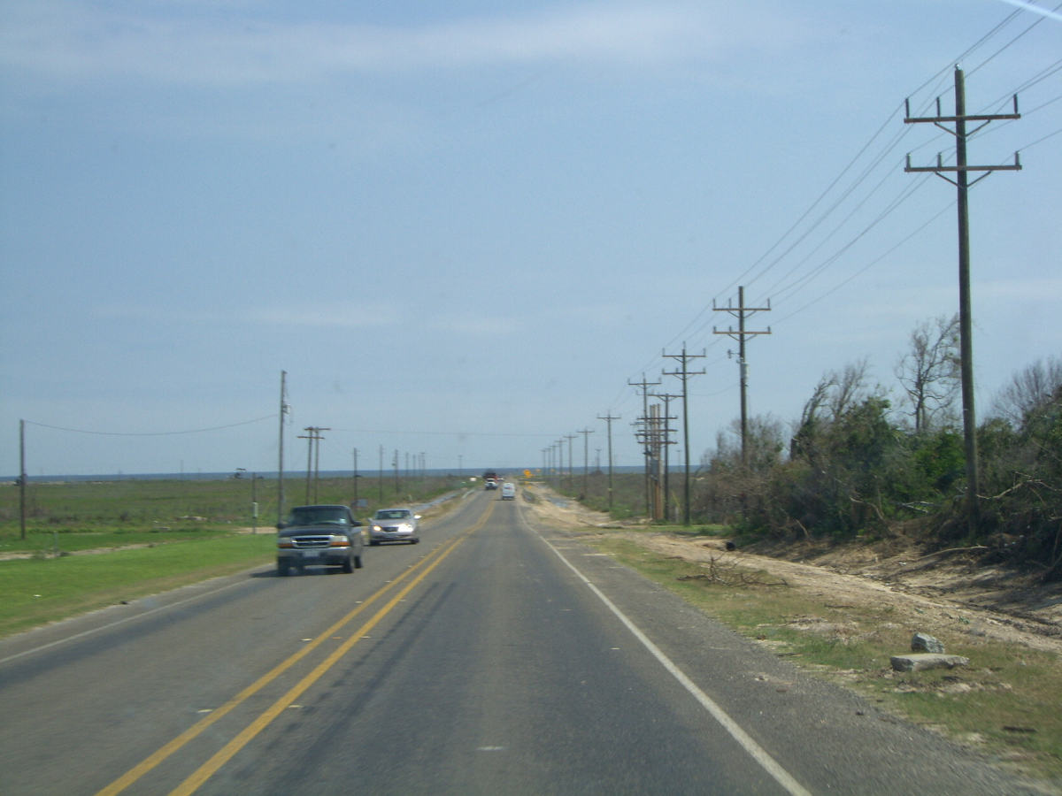
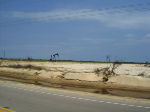
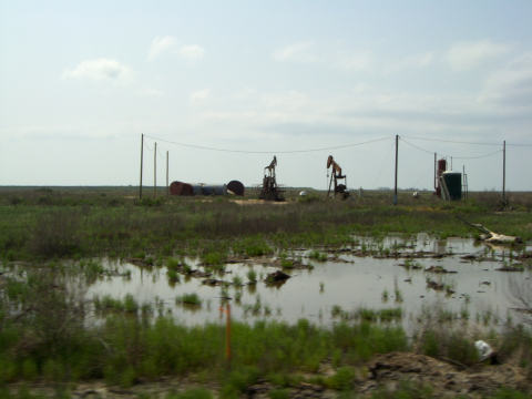
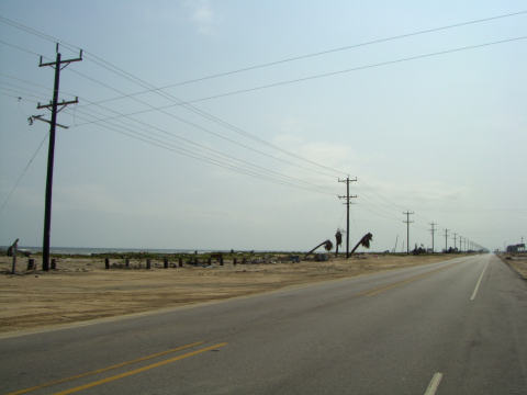
After touring the devastated Bolivar Peninsula,  we didn’t know what we would see when we arrived in Galveston.  On the Bolivar side, we found some landscaping (or clearing) on both sides of the approach to the ferry.

g-ferry-approach.jpg

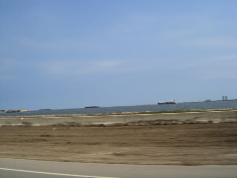
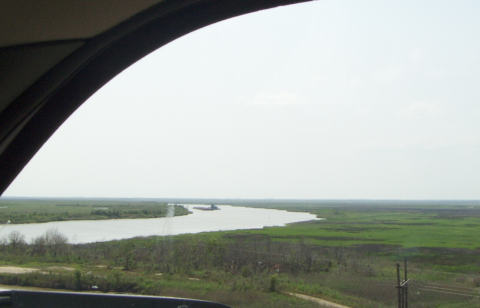
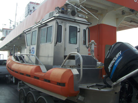
We hopped on the ferry and parked behind Rick’s dream boat.

g-boat1.jpg

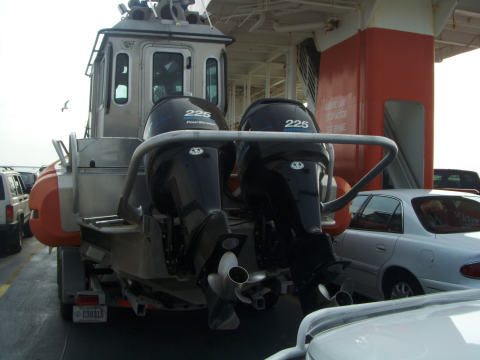
This boat was formerly a US Coast Guard patrol boat and similar to those we observed being used by the Border Patrol along the Rio Grande. (see our Rio Grande boat tour) Now it is operated by NOAA.

g-boat2.jpg

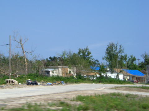
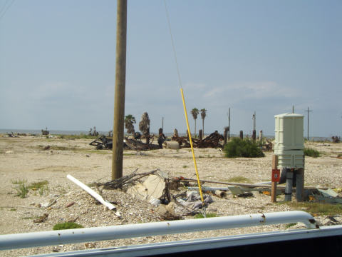
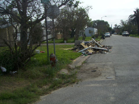
As we exited the ferry on Galveston Island we noticed that the clean-up continues.

g-trash.jpg

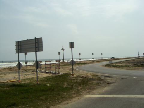
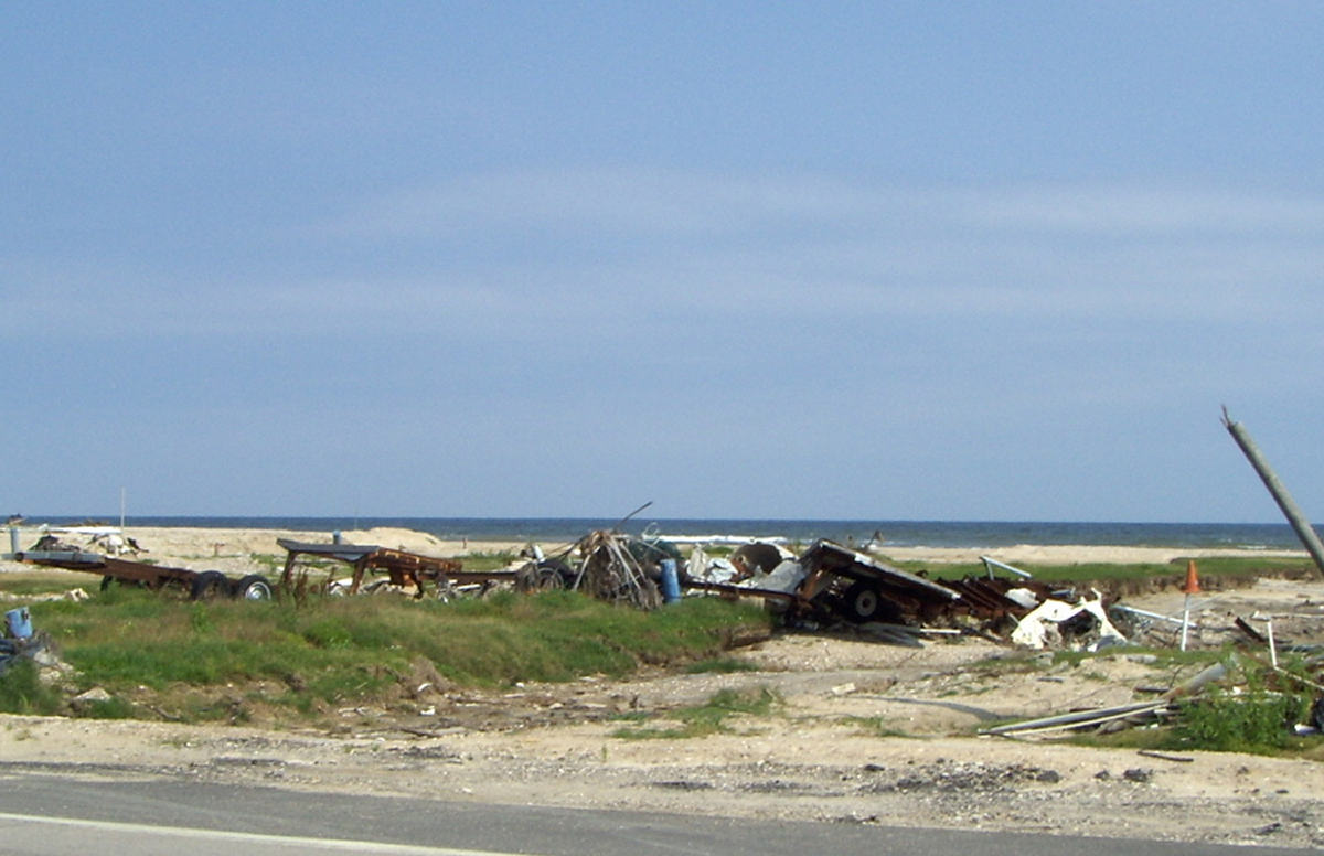
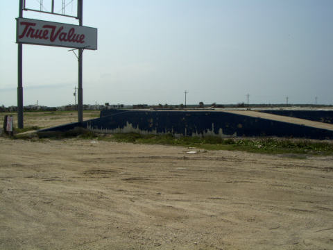
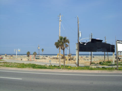
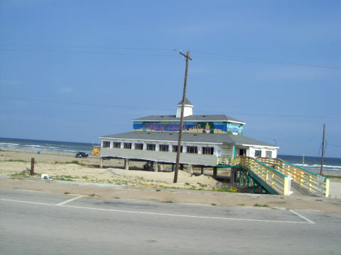
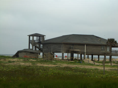
We noticed what used to be a large public beach area, stores and facilities.  Now it is “undeveloped”

g-beach1.jpg

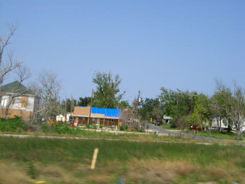
Next door we find what used to be a restaurant.

g-restaurant1.jpg

Years ago, Rick spent the night at the old Flagship Hotel that is located on a pier in the Gulf of Mexico.  It was kind of scary at the time, thinking about being over the water.  Now we can see that the fear was justified. At least the place was still standing as we approached, but Hurricane Ike wasn’t kind to the landmark.

g-flagship1.jpg

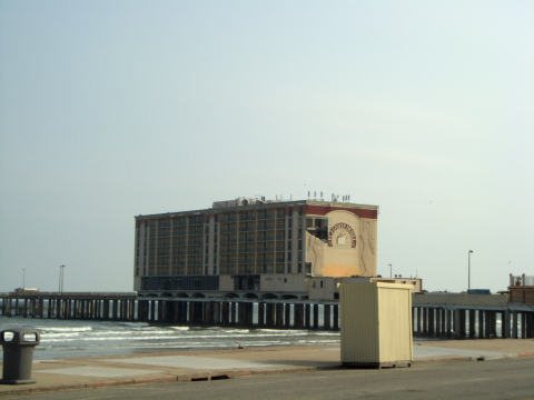
From the balcony of Fish Tales, a restaurant across the street, we were able to catch a panoramic view of  the Flagship. (Click on the Photo to Enlarge)

g-flagship-pan-480.JPG

Access to the hotel is a little tough.  The waves have knocked one of the two driveways from its mounts.

g-flagship2.jpg

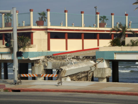
Also, some of the rooms  are a little more open air than most of us would appreciate.

g-flagship-room.jpg

We noticed the same damage at the Bahia Mar Hotel on South Padre Island after Hurricane Dolly.  The wind does some real damage on the corners where the rooms have a balcony.  The end wall starts tearing and continues around the side of the building.

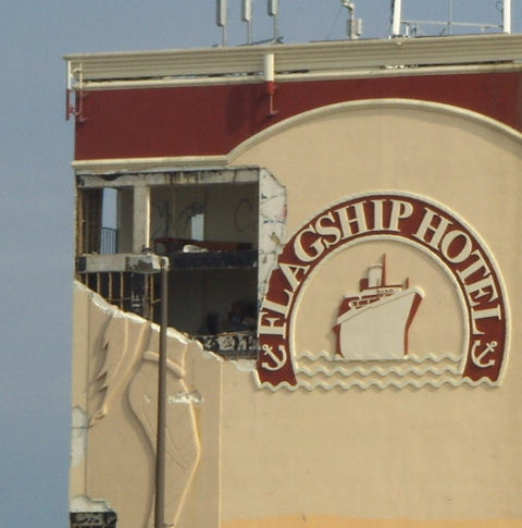
At least one of the 5-story art deco mermaids remained in tact.

g-mermaid-1.JPG

By the way, the Fish Tales restaurant is restored and didn’t disappoint. We finished up dinner at about 5:30 and headed farther south on the island.

It appears that the Galveston seawall has done a fairly good job in protecting most buildings.  Galveston didn’t get the huge storm surge that was seen on the Bolivar Peninsula.  You can see by the storm track that I modified from a NOAA source, that the storm came to shore at Galveston Bay and caused the stronger surge on the right hand size.

iketrack-crop.jpg

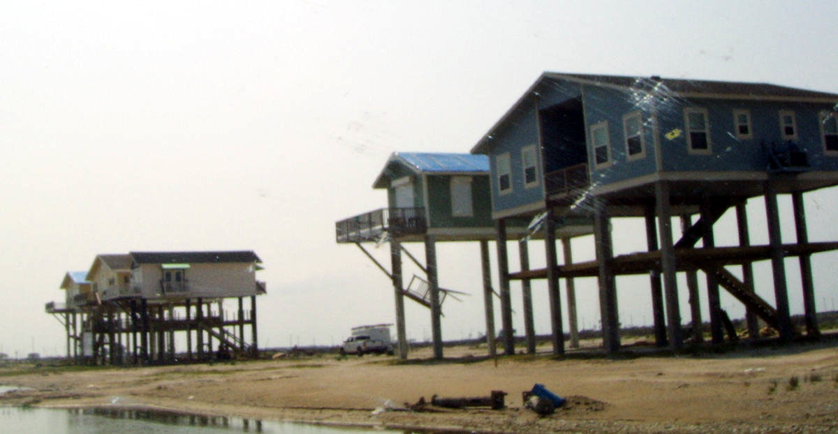
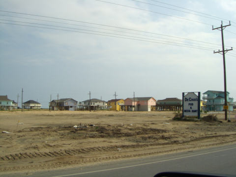
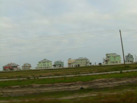
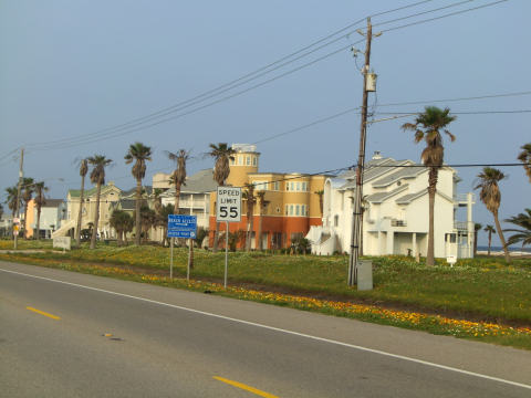
We were pleased to see that many of the colorful stilt house communities came through the storm pretty well.

g-houses.jpg

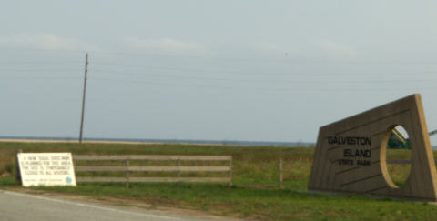
Last summer we spent a week, interrupted by Hurricane Edouard, at the Galveston Island State Park.  Oops, it’s gone.  The sign says that there is a new park in the planning stage.

g-state-park2.jpg

Well, at least there is a bathroom left.

g-state-park.jpg

Now, to the Three Little Pigs

Apparently the little pig that decided to use masonry, had things pegged pretty well.

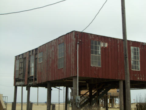
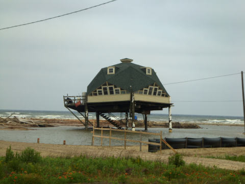
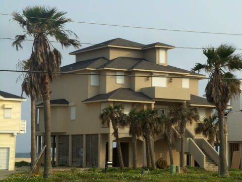
When Hurricane Ike huffed and puffed, it looks like a single story stilted house doesn’t cut it.

g-house-no-roof.jpg

This one has a pretty good sag going on.

g-house-stilt.jpg

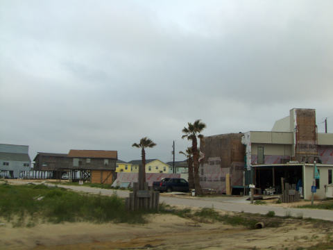
Here’s a neighborhood that is under reconstruction.

g-house-damage.jpg

Not even the geodesic dome houses fared very well.

g-house-dome.jpg

The third little pig would be proud of the way these homes fared. These homes are constructed in various styles, cinder block, solid cement blocks, and bricks.  Usually the first floor is used for storage and garage.  The lower area would have had some water damage, but the structures came out fine after some foundation repair.

g-house-brick1.jpg

Cement construction and storm screens seem to be the best.

g-house-brick2.jpg

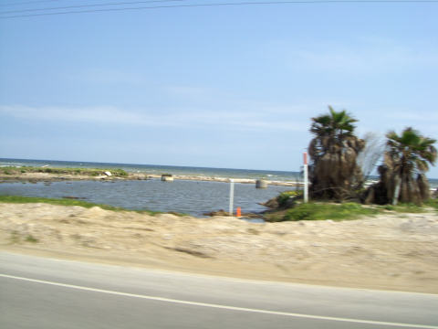
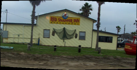
Before heading back to the mainland, we passed through Surfside.  There was quite a bit of damage in this town.  The Red Snapper Inn, one of our favorite restaurants in town seems to be back in business.

g-surfside.jpg

Across the bridge we went and headed into Freeport, TX on our way back to Rockport.  It was a long day, 14 hours and just about 600 miles.  We’re glad that we took the extra time to make this side trip.

If you’re in the area, local businesses would love your business and support.

What Was Bolivar Peninsula?

Thursday, May 14th, 2009

Click for Port Bolivar, Texas Forecast

The Bolivar Peninsula  was named for Simón Bolívar, the South American hero, is a “barrier island” stretching twenty-seven miles along the Texas Gulf Coast to form eastern Galveston County. One of the oldest settled places in Texas, the peninsula’s earliest occupants included Jane Long “the Mother of Texas”, her husband and his soldiers, and at other times many members of the pirate crews of both Louis Aury and Jean Lafitte. (You can CLICK HERE for more history information.)

Aside from being historical, Bolivar has been one of our favorite beach destinations for years.  On our way back from Dallas, we decided to take the long way back and take a look at the remaining damage from Hurricane Ike at Bolivar and Galveston.  (We wrote about the area in June-2007 and August-2008)

Our route took us around Houston and east on I-10 to the town of Winnie.  Winnie is about 20 miles from the coast, but the damage that we saw there was impressive.  Several business remained closed.  The gas station that we selected had several of its fuel pumps still laying on their sides.

From Winnie, we headed south to the coast.  We were amazed to see debris in the trees at about a 10-foot level.  We were still 15 miles from the water.  There had been quite a bit of rain recently so the coastal plains looked a little swampy.

aa-coastal-1.jpg

A few miles north of the coast, we crossed the Intracoastal Waterway.  From the bridge we spotted a barge being shoved around the bend.

aa-intercoastal1.jpg

Then we approached the town of High Island which is widely known as one of the premier bird watching locations along the coast.  At about 33 feet above sea level, the town didn’t fare too well from the 20-foot storm surge topped by 20-foot waves from Hurricane Ike.  Many of the homes still await repair.

aa-high-island-1.jpg

aa-high-island-2.jpg

As we left High Island and drove the final mile to the coast, we were surprised by the view.  Normally at this point the water is not visible because of the large sand dunes that protected the coast.

aa-bolivar1-480.jpg

When we reached the coastal road, nothing.  The dunes were gone.

aa-bolivar2.jpg

There was evidence that the dune sand had been deposited across the road on what used to be pasture land.

aa-bolivar3.jpg

aa-bolivar4.jpg

Don’t feel to sad for the farmers, the oil wells were pumping wildly.

aa-oilwells.jpg

aa-oilwells2.jpg

The Bolivar Peninsula runs about 27 miles west toward Galveston Bay.  There were two major towns on the peninsula, Crystal Beach and  Gilchrist.  Gilchrist has always been our choice to park our RV.  As we approached the “town”, we were amazed.  We used to see large numbers of beach homes in neighborhoods along the south side of the road and a few demo models on the other side.  Here was what we saw.

aa-gilchrist10.jpg

Click on the picture for a closeup of the three story model homes. Their extra story was all that saved them.

What is left of the typical home is a pond, some supports, and septic tanks.

aa-gilchrist2.jpg

Otherwise, not much left.

aa-gilchrist3.jpg

Here’s what is left of the Quality RV Park which was located on the beach and along a “cut” or fishing channel that accessed the bay side.

aa-qualityrv.jpg

Here’s what is left of the RV park on the other side of the road.

aa-other-rv.jpg

People are still fishing at the “cut”.

aa-cut.jpg

After crossing the cut, we head south to Crystal Beach.  We notice that the True Value Hardware didn’t fare well. This is where we shopped for our fishing supplies.

aa-true-value.jpg

Crystal Beach fared much better than Gilcrest.  Unfortunately our favorite restaurant and home of the best crab nachos, DeCoux’s Restaurant and Pub, bit the dust.

aa-decouxs.jpg

The main grocery store had a sign up that they had just opened.  We didn’t catch a picture of it, but we spotted a 5th wheel along side the road with a grocery store sign on it.  Some industrious individual filled a need with his trailer.  I guess he can close up business now.

Makeshift RV parks are cropping up to house the property owners and workers.

aa-makeshift-rv.jpg

It appears that the only school on stilts that we have seen has survived.

aa-school.jpg

We headed on to the ferry for our trip to Galveston.  We’ll pick up our story there on our next update.

We finally made it back to Dallas

Friday, May 8th, 2009

Click for Rowlett, Texas Forecast

We had intended to go visit our new grand baby, Eleanor Katie, a little sooner, but we wanted to make sure that neither of us were sick.

We didn’t take the interstate for the trip from the Corpus Christi Area to Dallas.  Instead, we decided to drive Highway US 77 north as far as Waco.  The ride was great.  We enjoyed seeing all of the greenery.  We haven’t seen much rain since September, but north of here they have been swamped.

Our first opportunity to see Katie was at her big sister’s (Gracie) soccer game.  More interested in milk than the game, Katie sat in her stroller.

a-katie.jpg

Daddy Justin  took a turn at burping detail.

a-justin-katie.jpg

Cousin Maddi strolled over to see if she could help.

a-maddi.jpg

On the game front, Gracie, #3, moves into position to score a goal.

a-gracie-soccer1.jpg

This made a two game scoring streak for Gracie.

Cousin Ayden chats with Gracie during intermission.

a-gracie-and-ayden.jpg

We had a wonderful couple of days visiting the kids and grand kids.  One day we did burgers with the best grill from the Kettle Metal Barbecue Co. Weber Smokey Mountain 22″Review, in the rain, and the next day we did some damage to some Williams fried chicken.

Tinka grabbed the opportunity to visit with Katie during one of her waking periods.

a-tinka-katie.JPG

Rick was still able to recognize the facial expressions that preclude a major diaper change, and his instincts proved to be accurate.

We elected to take the long route home through the Bolivar Peninsula  and Galveston, both ravaged by Hurricane Ike last year.  We’ll report on each of those areas in the next day or two.

Sand and Bodies Galore

Sunday, May 3rd, 2009

Click for Port Aransas, Texas Forecast

Port Aransas, a town at the north end of Mustang Island,  hosts its annual SandFest each April. This is a sand sculpture competition.  Numerous professional and over 200 amateurs took part in the 2009 version three-day festival.

a-title.jpg

In this  aerial photo by Dan Parker, The Port Aransas South Jetty,   you can see some of the 100,000 visitors that come to view the activities.

dan_parker_480.jpg

We made a short tour through the exhibits and returned on Monday, after the competition ended, to get a closer look.

One very large pile of sand was shaped into a display naming all of the sponsors for SandFest.

a-sponsors.jpg

Certain sand sculptures  are completed by individuals, some by duos and others, by teams of artists.

a-team-working.jpg

Some of the pictures are linked to a larger view if you are interested.

This one, “Consumed by Time” was our favorite and a favorite of the judges.

a-time-480.jpg

The detail in these musicians is amazing.

a-musician-480.jpg

From someone who can’t even draw a hand that doesn’t look like a stick figure,  I can’t imagine creating one out of sand.

a-hand-480.jpg

This castle is one that I couldn’t imaging keeping in tact without falling.

a-castle.jpg

How about Margaritaville?  See the shaker of salt, etc.?

a-marg480.JPG

More of a sun worshiper design

a-sun.jpg

Can you imagine creating the blanket shown here from sand?

a-fabric-480.jpg

Oops, somebody got swallowed up by a shell.

a-shell.jpg

It looks like someone found something that they could make out of old lace doilies.

a-lace-doily2.JPG

Just couldn’t resist.

You may want to put next year’s SandFest in your itenerary,  April 9, 10, and 11, 2010.

Fan Issues

Friday, May 1st, 2009

Click for Rockport, Texas Forecast

You can imagine my surprise to be comfortably working a Sudoku problem and hear a loud clatter right above my head. Apparently the exhaust fan had chosen this time to perform dis-assembly.

fan.jpg

The fix to this problem is much easier than I made it to be.  I won’t go into my initial method.  The correct fix is to:

  1. Remove the fan frame (held together by four screws).
  2. Remove the crank handle.
  3. Remove the two screws holding the screen.
  4. Pull what is left of the fan blade off of the shaft.
  5. Take the old blade to the store to insure that you buy the correct orientation, Left Hand vs. Right Hand.
  6. Push a new blade onto the shaft.
  7. Re-assemble everything in reverse order.

Cost for the repair was $8.68.

Follow-up note: The fan blade was really brittle and when it came apart, it just shattered. The guy at the RV shop said that it is made from the same material as the vent covers.  That may explain why they will all eventually crack.  They always last longer than the warranty, so it must be planned obsolescence.