Archive for April, 2008

Santa Fe, Bandelier and Taos

Wednesday, April 30th, 2008


On our fast paced journey east toward Texas, we stopped and visited Santa Fe and Taos, New Mexico.  These are two of our favorite towns.

SANTA FE

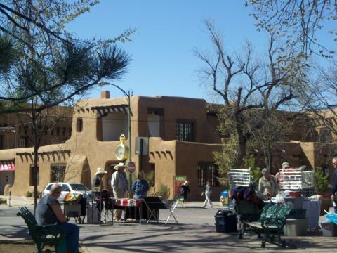
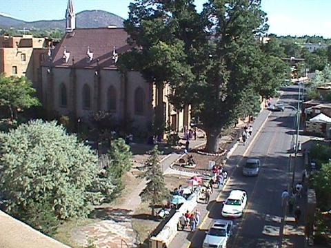
Santa Fe occupied by the Pueblo Indians from the year 1050 until 1607 and was established as a town by the Spanish in 1610.  It is the oldest capital city in North America.  You can read more about the history of Santa Fe at: http://www.thesantafesite.com/history.html.

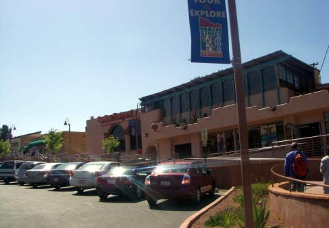
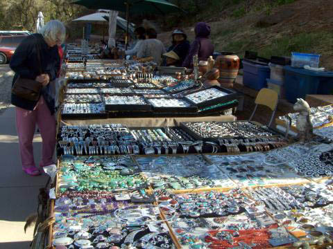
If you’re looking for things Southwest, this is the place to come.  The square is filled with shops loaded with beautiful art, jewelry, furnishings, and clothing.  Local Indians line the square to sell their arts and crafts.

a-sf-square.jpg

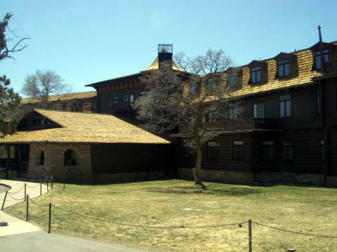
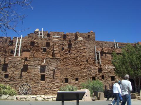
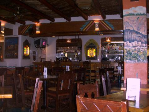
The La Fonda Hotel is a good place to stop for a drink or at least to look around.  The bar is very comfortable and, oh yes, quite expensive.

a-la-fonda-bar.jpg

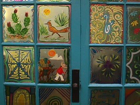
Santa Fe is famous for its doors.  As a matter of fact, there are merchants in Santa Fe that sell nothing but doors.  This photo shows some of the painted glass-work that can be found on doors at the La Fonda Restaurant.

a-la-fonda-painted-glass-1.jpg

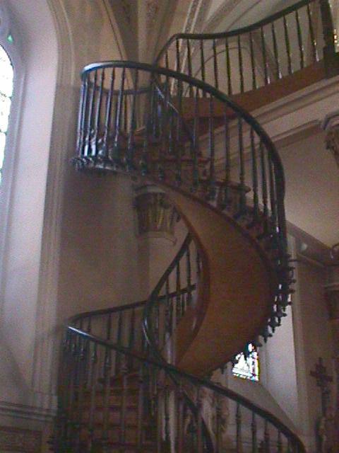
The Loretto Chapel is another must see location in Santa Fe.

a-chapel.jpg

Inside the chapel there is a mysterious spiral staircase that makes two full revolutions and has no visible means of support.  It was also built without the use of nails.  Information on the legend of the staircase can be found at: http://www.lorettochapel.com/staircase.html.

a-chapel-stairs-1.jpg

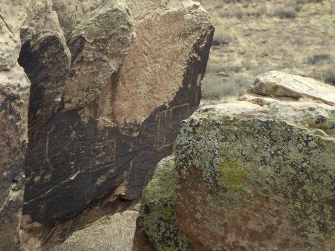
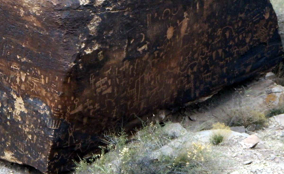
When heading north from Santa Fe you’ll come across Camel Rock.

a-camel-rock.jpg

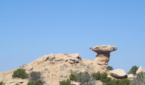
Camel Rock seems to have become another excuse for a casino.  Casinos litter the landscape north of Santa Fe.
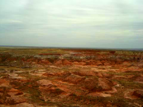
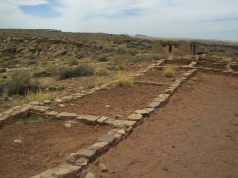
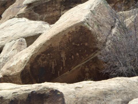
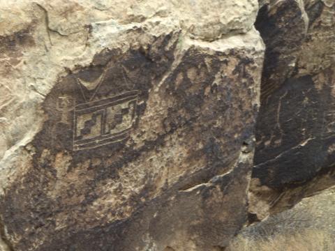
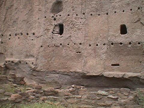
BANDELIER MONUMENT

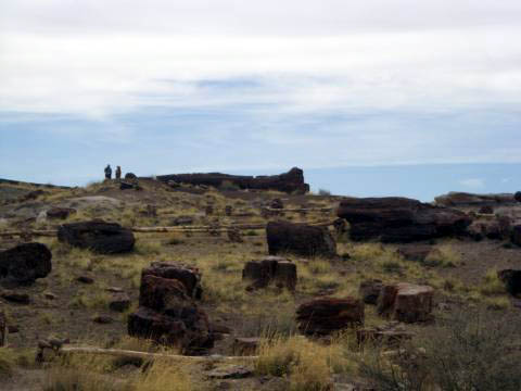
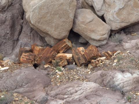
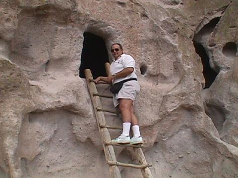
About 30 miles north of Santa Fe, near Los Alamos, you will find the Bandelier Monument.  If you do nothing else on your visit to Santa Fe, this is a must stop at least once in your life.  For about 10,000 years, the ancestors of the Pueblo Indians made dwellings in the cliffs and built ceremonial structures in the surrounding wilderness.  Don’t miss it.

a-bandalier-cave-dwelling-3.jpg

Gotta watch that first step.

a-bandalier-rick-on-ladder.jpg

More information about the Bandelier National Monument can be found at: http://www.nps.gov/band/.

TAOS

Tinka’s cousin, Steve, has been living in the Taos area for over 20 years.  So, with only a couple of days notice, we  descended upon Steve for a visit of this beautiful location.  This worked out well, because, unknown to us, some years back Steve had been a tour guide in the area.

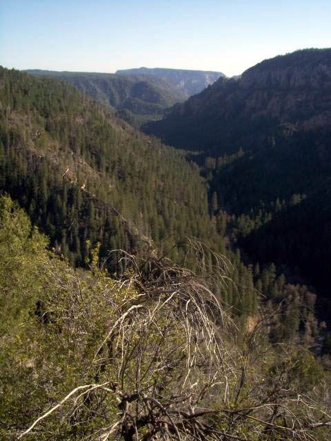
There are basically two ways to get from Santa Fe to Taos.  The low road, which follows along the Rio Grande River, is the most direct route.

a-rio-grande1.jpg

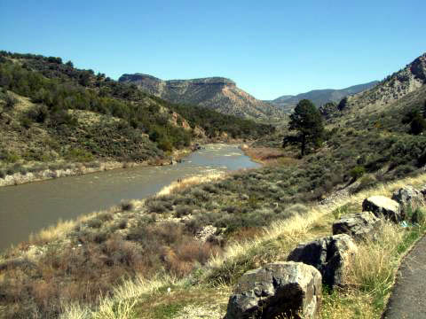
I don’t think that this much water ever makes it to the Texas and the Mexican border.  This is the road that we took on our way to Taos.

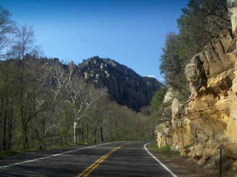
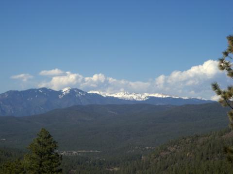
The other route is the high road, which reaches altitudes of 9500 feet.  We chose this one for our return trip.  Yep, that’s snow, you know, the stuff we have been trying to avoid for 6 months.

a-high-road.jpg

Back in 1772, the San Francisco de Asis Mission was built in Taos.

a-adobe1.jpg

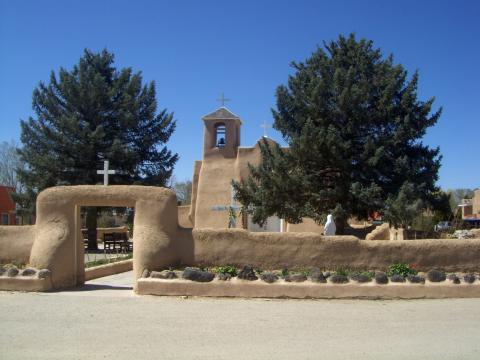
The mission is made of adobe and the walls are several feet thick and was used as a defensible location when the community came under attack in less friendly times.

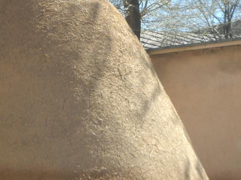
Adobe structures require annual maintenance to keep them from becoming a pile of mud and straw.  Each summer the building must be resurfaced with new mud.  This is a shot of the corner of the mission.  You can see the straw showing through to the surface.

a-adobe2.jpg

A building across the street has not had the tender loving care granted to the mission.

a-adobe4.jpg

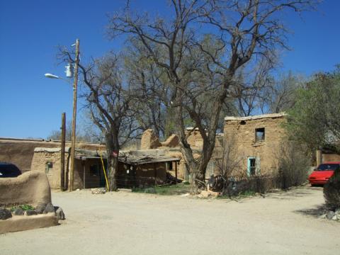
I guess they have a law requiring adobe style design because that is all that can be found throughout most of New Mexico.  Newer adobe style buildings have modern surfaces that don’t require the annual mud resurfacing.

a-adobe3.jpg

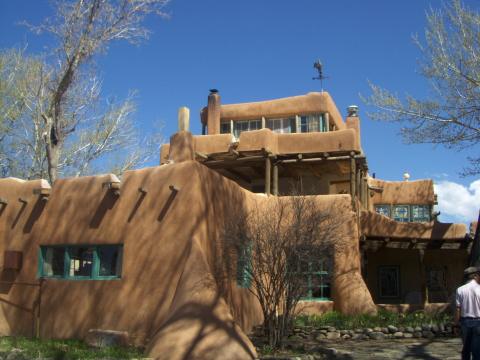
Dennis Hopper, who fell in love with the area while filming the movie Easy Rider, bought the house shown above.  It is now a bed and breakfast.  As you can see by this photo of Tinka and Steve, some of the doors inside the B&B are a little small for Rick.

a-tands.jpg

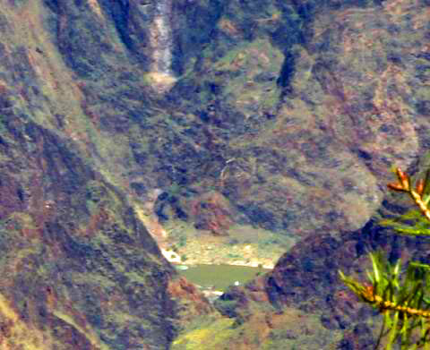
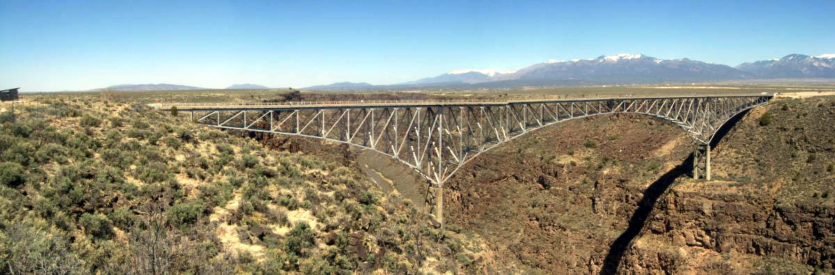
Just outside of Taos is a bridge across the Rio Grande Gorge.  The bridge is 650 feet above the river below. (Click on Photo for Panoramic Shot.)

a-rio-grande3.jpg

Looking up the gorge from the bridge is a fantastic view. (Click on Photo for Panoramic Shot.)

a-rio-grande2.jpg

The Taos Pueblo is an Indian community that has been continually occupied for over 1000 years.  It is one highlight that we didn’t have time to visit.  We’ll make sure that we go there on our next visit.

We want to thank Steve for taking time to show us around.  On our next trip, we’d like him to bring along his neighbor Julia Roberts.  We’ll spring for lunch.

The Painted Desert and The Petrified Forest plus Route 66

Tuesday, April 29th, 2008


Well, you can see that we’ve been on the move.  We just arrived in Weatherford, TX, our old stomping grounds, to tend to doctors and swap things in and out of storage.  While here, we’ll visit with friends and family.

On our way from Flagstaff we stopped in Holbrook, Arizona so that we could take a look at The Painted Desert and The Petrified Forest.  The Painted Desert covers over 93,000 acres and stretches from the Grand Canyon  to the Petrified Forest near Holbrook in eastern Arizona.

THE PAINTED DESERT 

The National Park Service has set up a park east of Holbrook that curves through scenic areas of the Painted Desert and crosses Interstate 40 to meander through the Petrified Forest and ends up in Holbrook.  Once again, Tinka’s lifetime senior pass to the National Parks came in handy.

The park can be entered from either end, but we elected to enter on the east end just north of I-40.  The museum just past the entrance is a good place to pick up literature and information about the park.  After the museum we were greeted with fantastically beautiful panoramas.

1a-painted-pan-1200-thumb.jpg

You can click on the above picture to enlarge.  What makes up the color are layers of mud, sandstone, and volcanic ash in combination with various minerals.  Unfortunately the overcast skies didn’t help capture the beauty of the landscape. 

1a-painted-still.jpg

Over 93,000 acres of the Painted Desert were developed later than the Grand Canyon.  The fossil record in this area traces back to the Triassic Period, about 220 million years ago.

As we followed the park road across I-40, toward the south,  we arrived at the Puerco Pueblo Ruins.  This was a community that was populated between about 1250 AD to 1380 AD and located near the Puerco River.  The residents of this community had contact with the Zuni Indians from the mountains and the Hopi Indians from the deserts.

1a-petr-pueblo.jpg

The ruins of the Puerco Pueblo overlook the valley and river below. (The restroom in the background is a little more recent.)

Just below the ruins we found rocks adorned with ancient petroglyphs.

1a-petroglyph1.jpg

1a-petroglyph2.jpg

1a-petroglyph3.jpg

Several miles from the Puerco Pueblo, in the midst of the Petrified Forest, we found a display of more petroglyphs.

1a-newspaper-sm.jpg

This is known as Newspaper Rock.  It contains over 1000 petroglyphs.  Click on photo to enlarge.

THE PETRIFIED FOREST 

The Petrified Forest is amazing.  Years ago, when this area was a tropical forest, fallen trees were swept downstream and were covered with sediment.  In the ensuing hundred years or so, the wood was replaced with various crystals forming the rocks known as petrified wood.  Had the wood been exposed to the air it would have simply rotted away.  Years later, erosion exposed the petrified wood.

1a-wood-field.jpg

You can see the size of these logs in comparison to the people standing beside the one at the top of the hill.

1a-wood-field-2.jpg

The landscape varies from one extreme to the other, but the petrified wood can be found scattered about in all areas of the park.

1a-wood-field-3.jpg

The petrified wood looks like it has been sawed from larger logs.  In fact, the “wood” is so brittle that it has broken as the earth shifted around it over the eons.

Near the end of our tour we found another museum iwithn the park that showed examples of fossils and animals that date back to the Triassic Period.

1a-alig-mouth.jpg

Tinka is examining the skull of a Leptosuchus Gregorii, a 17 foot, 2100 pound alligator type former resident of the area.

It is illegal to take any petrified wood from the park and your vehicle may be inspected at the exit.

That said, you can buy petrified wood from just about anyone that lives in the area.  The RV park (Root 66 RV Park) even had a shop.

1a-wood-sale.jpg

Outside the park, on the south side of Holbrook, there are many petrified wood merchants.  This one had fields of petrified wood and fossils for sale.

For more information, and probably better pictures, of the Painted Desert and the Petrified Forest visit: http://www.nps.gov/pefo/

ROUTE 66

We had been traveling along Interstate 40 for quite some time.  Business I-40 at most towns was formerly the historical Route 66 and is usually the main street of most of the towns.

1a-66poles.jpg

In some areas, only the telephone poles remain where Route 66 used to be.

1a-66car.jpg

Old cars can be found throughout the area.

1a-66bldgs.jpg

It seems that all the buildings along Route 66 were all built at about the same time.

1a-66signs.jpg

It appears that the sign posts remain but the message may have changed.  The sign of the left is for Wayout West CD’s.

If you are a fan of Oprah’s, you may have seen her show series last year when she and her friend Gail drove across the country.  One of their stops was in Holbrook and the Wigwam Motel.  (CLICK ON PHOTO TO ENLARGE)

1a-wigwam-thumb.JPG

I’m not sure whether Oprah and Gail spent the whole night there, but the motel rooms are actually wigwams that are scattered around the property. Check out the age of the cars that are parked near the wigwams.  They are permanent fixtures.

On our way to Texas, we also stopped for a visit in Santa Fe and Taos.  We’ll talk a little about that on our next entry.

Arizona – The Grand Canyon

Tuesday, April 22nd, 2008


We stayed at the Canyon Gateway RV Park in Williams, Arizona.  (On a side note, about 100 trains go through Williams every day.)  The park is associated with the Passport RV group and is very easy to find and conveniently located about 25 miles east of Flagstaff.  When we checked in at the park we indicated that we intended to tour the Grand Canyon and picked up brochures to help the planning.

Our intent was to put our Lifetime Senior Passes to work since the Grand Canyon is a National Park.  The more we studied it became evident that a guided tour would be our best bet.  We opted to drop $85.00 each for Marvelous Marv’s Grand Canyon Tour, http://www.marvelousmarv.com/.  Marv picked us, and two other couples, up at the RV park at 8:30 AM and led us throughout the park sharing his years of Canyon tour experience and returned us safely home at 4:00 PM.

We’ll try not to bore you with too many photos that you’ve probably already seen.  But we can’t resist a few.  Here’s a panoramic shot that I took at our first sight of the canyon.  (CLICK ON PICTURE TO ENLARGE)

1a-pan-thumb.jpg

Marv took a picture of us.

1a-rick-and-tinka-at-gc-a.jpg

At an information area near the rim, numerous books and displays illustrated the history of the canyon.  The geology of the area is fascinating.  The Grand Canyon formed through plate tectonics, wind and water erosion.  There are at least seven major faults in the canyon and evidence that certain layers of the canyon are consistent with being connected to Africa when it was part of a super-continent.  Anyway, the various layers indicate that the area of the Grand Canyon has been uplifted and submerged numerous times.  The bottom layer of vertical rock is actually the earth’s mantle and the top layer is a thousand feet of limestone that has been compressed to 600 feet of sandstone.  The top layer is called the Kiabab Limestone and was deposited beneath the sea over 250 million years ago.  All layers, including the top one, are older than the dinosaur record.  More information regarding the canyon’s geology can be found at http://www.bobspixels.com/kaibab.org/geology/gc_geol.htm.

1a-strata.jpg

Snow is still present amongst the 90-foot trees on a ledge below.

1a-snow.jpg

One of the most popular things to do in the park is to ride a mule into the canyon.  Unfortunately they have a 200 pound limit and therefore Rick can’t ride the mules.  Oh, there is also a 13 month waiting list. They have one and two day rides.  On the return trip in the van, Marv played a video showing the mule ride.  The path shown in this photo, follows to a point near a cliff where the riders have lunch.  This point is about halfway to the bottom of the canyon.

1a-trail.jpg

In this photo you can see a spot of the Colorado River about a mile below.  At this spot in the river there is a camp where people hikers, riders, and rafters will spend the night.

1a-river.jpg

In the 1880’s the train started bringing tourists to the Grand Canyon.  This lodge was built to house the guests and the suites overlook the train station, not the canyon.

1a-lodge.jpg

Across from the lodge is a gift shop that was designed by Mary Jane Colter, a female architect employed by restaurateur Fred Harvey in the early 1900’s.  She designed this shop and several other buildings in the park.  The shop is fashioned after an Indian pueblo.

1a-shop.jpg

We were shown backgound areas of the park that we would not have seen had we ventured out on our own.  Most of the employees live in the park and there is a school in the park for their children.  

We thoroughly enjoyed our tour and would recommend Marv to anyone interested.

Meteor Crater – Arizona

Monday, April 21st, 2008

We used to think that Texas had varied climates and topographies but perhaps Arizona’s variations are more dramatic.

We headed about 35 miles east of the mountains of Flagstaff, near Winslow, to go to Meteor Crater.  This was Jeff Bridges’ destination in the movie “Star Man”.  The area east of Flagstaff is a high plateau that is at an elevation about 5700 feet above sea level.  The crater is located about 3 miles south of Interstate 40.   As we approached the crater we could see the Welcome Center in the distance. 

a-center.jpg

Meteor Crater (http://www.meteorcrater.com) is privately owned and operated.  We were quite impressed with the facility.  They have a movie theater that runs a 10-minute informationional video every half hour, a museum that has a varied collection of astronomical and geological displays, both high and low tech.  The facility also contains a gift shop and a Subway restaurant. Near the I-40 exit they have an RV park.  The road is fine and there is ample parking for any size rig.

a-parking.jpg

It was a little hazy, but you might be able to see the mountains near Flagstaff in the background.

a-window.jpg

The crater was formed about 50,000 years ago by the impact of a chunk of rock about 150 feet in diameter.  The crater is about 4000 feet in diameter and 570 feet deep.  It has collected some dust and filled in from its original depth of 750 feet. (CLICK ON PICTURE to open a larger picture in a new window.}

 1a-crater-thumb.jpg

From the Welcome Center there are several viewing locations and walking tours around the crater are available.

The crater has also been used as a training center for Apollo astronauts.  Space suits were tested and astronauts were taught what type of lunar rocks to collect.  The Wall of Honor lists all of the astronauts.

a-astro2.jpg

The first few panels contain the well known names of the Apollo lunar astronauts.

a-astro1.jpg

There is a test Apollo capsule on display that was used elsewhere to test flotation capabilities.

We spent about two hours at the facility and found the information and scenery fascinating.  The cost for entry is $15 per person and $13 for seniors.

Sedona and Oak Creek Canyon

Wednesday, April 16th, 2008

If I didn’t know that we were in Arizona, I’d swear we were somewhere in the northwest. 

One summer back in the middle of the last century, Tinka was in college in Flagstaff.  She said that she would go down toward Sedona, AZ to what is now Slide Rock State Park.  In those days it was an apple farm but Oak Creek ran through the middle of it.  It was also before water slides, but Slide Rock is a natural 75-foot butt-ride down the hill.  The weather was a little to cold for Tinka to relive an old experience, but others weren’t so chicken.

a-slide2.jpg

The apple farmer that owned the area prior to it becoming a state park, Frank L. Pendley, built a few tourist cabins on the property in 1933.  Sorry, they aren’t renting them out any more.

a-tourist-cabin.jpg

Heading south on Hwy 89a toward Slide Rock we were treated to a beautiful drive through the pine-covered mountains.  Happily we did not have our 5th wheel with us on this trip.  One stretch of the road drops about 1800 feet in about a three mile stretch of switchbacks.  There are three of them in this photo.

a-switchback.jpg

From up on top, we could look down at our road on the valley floor.

a-valley2.jpg

Once we made it down, here’s a look back at the hill we descended.

a-looking-up.jpg

After not sliding on the rocks, we headed another 8 miles south to the town of Sedona.  Sedona was made popular by more than 40 movies that were filmed in the area between 1931 and 1985.  The first was the filming of Zane Grey’s novel, “Riders of the Purple Sage”.   Once the famous panorama hit the screens it was hard to keep people away. (CLICK ON THE PICTURE TO ENLARGE)

a-sedona-p1thumba.jpg

The town of Sedona has grown into quite a tourist area.  The homes are spread out around the hills.

 a-sedona-city1.jpg

Shops line Hwy 89a.

a-sedona-city2a.jpg

On our return trip back up the hill toward Flagstaff, we spotted some Indian art and jewelry vendors.  Like we haven’t seen enough vendors lately.  Anyway, we stopped and escaped unscathed.

a-indians.jpg