Archive for February, 2009

Rio Grande Boat Tour

Saturday, February 28th, 2009

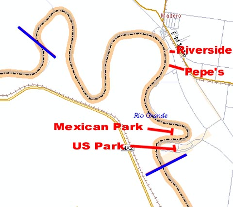
For those who thought that the Rio Grande is not much more than a stream, here’s a different view.  The Rio Grande begins in Colorado and works its way through New Mexico and the southern border of Texas until it dumps into the Gulf of Mexico.  (We wrote about the river earlier this year in http://tinka.net/2008/04/30/santa-fe-bandelier-and-taos/. )In the area of Mission, Texas, the Rio Grande is about 300-500 yards wide and runs about 25 feet deep.  On one of the few cloudy days we’ve seen, a group of about 65 from our park headed off to Mission and to the Riverside Club Restaurant for a river boat tour.  Referring to the map below, the tour started at the Riverside Restaurant and covered the river between the blue lines.

a-tour-map.JPG

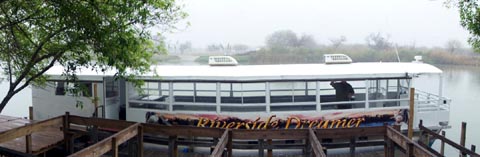
We boarded the Riverside Dreamer for the tour for the first of two groups.(Click to enlarge)

a-boat-480.JPG

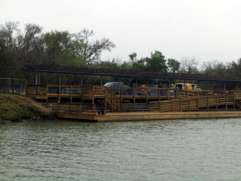
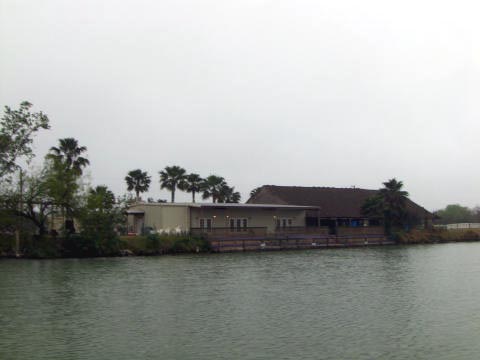
This is the Riverside Restaurant as seen from the boat.

a-riverside-1.jpg

The Riverside menu looked pretty good.  Their specialty is the pork loin sandwich.  We’ll have to come back and try it out.

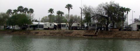
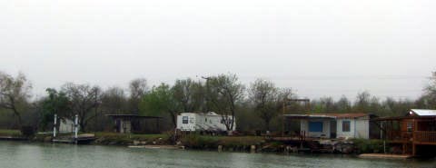
As we headed west on the river, we passed a number of RV parks on the shoreline.

a-river-rvs-2.jpg

Some were not formal RV parks, just RV’s set up on land as fishing cabins.

a-river-rvs-1.jpg

a-river-rvs-3.jpg

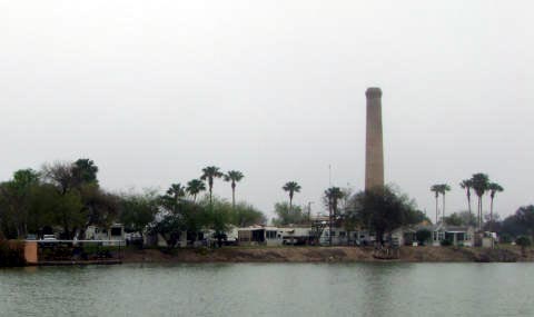
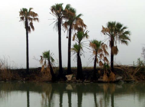
Further west along the river, the  US side becomes mostly sugar cane fields.  The picture below shows evidence of the recent burning of the cane fields and the damage that it caused this grove of palm trees.

a-trees-burned.jpg

Residents of both countries, the United States and Mexico, have full use of the river.  South of the border the river is known as the Rio Bravo, like in the 1959 John Wayne, Dean Martin movie.

As you can see by the map above, Mexican Hwy #2 follows the southern side of the river, therefore, the Mexican side is has a little more development than does the US side.   There were several parks and recreation areas along shore. At one curve in the river there are parks on both sides.  In this case, this Mexican park is located on the north side of the river. (See map above)

a-mx-park-n.jpg

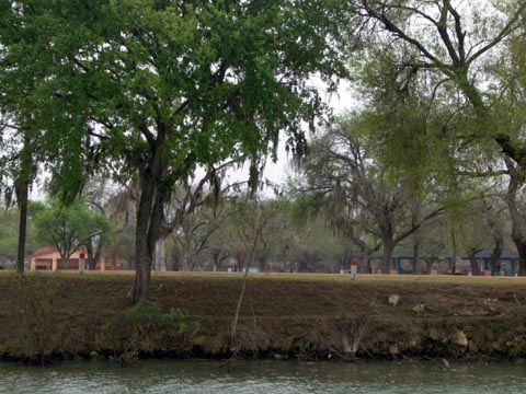
And this US park is located on the south side of the river.

a-us-park-s.jpg

We came across a beautiful log cabin estate on the Mexican side of the River.  As with many properties along the shore, they have their own boat ramp. (CLICK ON PICTURE TO ENLARGE IMAGE)

a-log-cabin-480.JPG

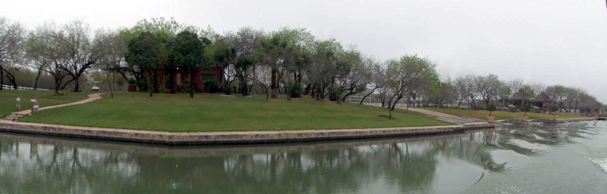
Remember, that is a Mexican house.

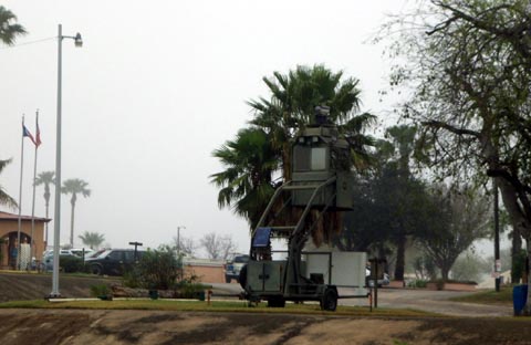
In case you’re wondering, US Homeland Security is staying busy.  Here is an observation station located on the shore of an RV park.

a-border-patrol-stand.jpg

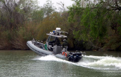
The river is also patrolled by border patrol boats.

a-border-patrol-boat.jpg

After the hour-long cruise, we headed over to Pepe’s Restaurant for lunch.We wrote that restaurant up in an earlier post – CLICK HERE.

a-pepes1.jpg

This side trip was well worth while.  We would recommend it to anyone and the price is only $7.50 per person.  Here is more information on the Riverside Club and Cruise.

New Granddaughter, Eleanor Kate Levvis

Friday, February 27th, 2009

Click for Rowlett, Texas Forecast

Today we are proud to announce the healthy birth of our fourth granddaughter, Eleanor Kate Levvis. She weighed in at 7 pounds, 13 ounces and measures 20.25 inches.

Her proud parents, Kiri and Justin are thrilled with the arrival. Older sister, Gracie, can’t wait to help out and teach her all the tricks.

Here is Katie’s first photo – being held by Grandma Nola.

eleanor-kate-levvis-1st-pic-480.JPG

We love y’all.

Happy ### Birthday, Rick

Saturday, February 21st, 2009

Rick’s spending his birthday waiting for more 3-D shows on TV.

3d-zoom.gif

First 2009 Visit to the beach

Saturday, February 14th, 2009

On Thursday, we made a 27-mile trip to Harlingen for an early morning appointment.  Since we were halfway there, we headed out to South Padre Island with the Jeep. Our earlier visit, in January with Roland and Karen, was limited to our transportation capabilities.  We have learned that the truck is not a beach vehicle.

On that earlier visit, our camera ran out of juice and allowed us to catch only one photo.  This time, we forgot the camera altogether.  Photos on this entry are courtesy of my cell phone camera.

When we reached the island, we headed north to the last beach access (#6) which is 2 miles short of the end of the road.  This access has deep sand and there were two vehicles stuck.  We drove around them and used our winch to extract one Cadillac.  The other vehicle was a pickup towing a trailer.  We had no luck with that one.  The winch just dragged the Jeep across the sand with all wheels locked.  We left the guy with the number for a towing service.

We had not been to the beach at SPI since last summer, just before Hurricane Dolly. Except for some debris in the dunes, we’ve never seen the beach cleaner. The tide was out and the beach was hard and flat.  Perhaps the truck might have made it this time.  The heavy layer of large shells made the travel even smoother.

Check out the best quality of airless paint sprayer which is ideal for your home and office use purpose

a-shells1.jpg

a-shells2.jpg

About 10 miles north of Access # 6 we spotted a makeshift “sculpture” of leftover hurricane things.

a-junk-tree.jpg

Another couple of miles further we spotted some stuff in the dunes and walked over to take a look.  Some people had set up this nice collection of items at a great vantage point in the dunes.

a-things.jpg

They even had a couple of televisions.

All along the beach there were people enjoying the water and individuals and couples (even nekkid ones at about 12 miles) were fishing.

lady-fishing-550.jpg

The water temperature was about 70 degrees.  Not bad, if you’re a Canadian or a Yankee.

We continued on until we reach the jetty that separates  South Padre Island from Padre Island.  The jetty is 23.5 miles north of Access #6 and is constructed of huge blocks of pink granite.

a-granite-jetty.jpg

You can see that the island separation isn’t very wide.  There are lights at the end of both jetties.

a-across-jetty.jpg

The jetty, not only provides separation of the two island, but, boat access to the town of Port Mansfield, which is located on the mainland.

a-sat-view.JPG

That shot didn’t come from my phone camera.

The repairs, in town, from the hurricane are moving along quite well.  It looks like they will be ready for Spring Break.

We had a wonderful day of exploration and can’t wait to get back there to enjoy the water. (Once it warms up to suit these Texas bodies.)

Happy Birthday, Maddi!!

Saturday, February 7th, 2009

We’re unable to attend the birthday party that is being thrown, in the Dallas area, to celebrate our granddaughter Maddi’s 4th birthday.

maddi-0109.jpg

The crowd is arriving at Marc’s house as we write this post.  I’m sure that all will have a good time.  Maddi understands that this is her day and will certainly get her share of the cake.