Archive for the ‘Mexico – San Carlos’ Category

Catch-22 and Time

Friday, April 4th, 2008

 In 1970, the movie Catch-22 was filmed, in part, at Playa Los Algodones in San Carlos, Mexico.  The beach is some of the most beautiful white sand dunes that we have seen.  You can see that new construction is cropping up on the northern edge of the beach.

a-algodones1.jpg

Looking to the south, the dunes stretch back about a quarter of a mile toward the road.  Apparently the Mexicans are trying to be diligent about the preservation of the dunes.  Their efforts may be sending the wrong signal.  There are signs at the beach that you can’t ride horses or 4-wheelers on the beach or in the dunes.  To enforce this, a police officer was perched on top of the dunes with his 4-wheeler.

a-algodones2.jpg

I’m sure that back in 1970 you could look out over the bay and see nothing but sand.  Here’s what Playa Los Algodones looks like today from the hills to the south.

algodones.JPG

In another 38 years you probably won’t see anything but condos and hotels.

San Carlos, A Last Look

Sunday, March 30th, 2008

Before leaving San Carlos last week we decided to take a drive to the far end of the bay where we could see lights at night from the shore.  This was in the direction of Guaymas, but mid-way between the towns.  We found several large complexes of condos.  You can see one of them on the right-hand part of this picture.  San Carlos is across the bay.  Click on Picture to enlarge.

a-condos-sm.jpg

In this area we discovered a piece of property that we might be able to afford.  It appears that someone gave up on their dream and left.

 a-ambandoned-house.jpg

We continued around the bay and came across some interesting rock formations, one in the mountain…….

a-rock-hole.jpg

And another little island rock…..

a-rock-island.jpg

A little farther around the bay we arrived in an area of nice homes and a fishing fleet.  I’m not sure whether one has anything to do with the other.  Many of the boats were out doing what they do, but a few remained.

a-fishing1.jpg

This market area appeared poised for the return of the boats so that they would have something to sell.

a-fishing2.jpg 

On the far side of the bay we ran into the Playa de Cortez Hotel and Trailer Park.  We hadn’t seen any reviews of this park, but it looked pretty nice.

a-cortez-rv1.jpg

Each site had some shade and a concrete “patio”.  A rig the size of ours, with 4 slides may have had a little problem with the width of the sites, but you could fit about any length in them.  If you wanted to be out of the hustle and bustle of San Carlos or Guaymas, this might be the spot.

a-cortez-rv2.jpg

San Carlos to the US Border

Friday, March 21st, 2008

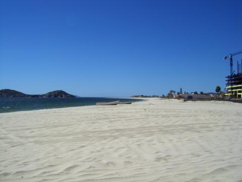
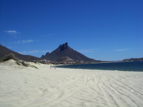
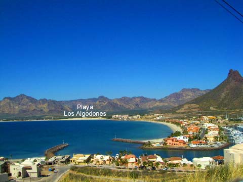
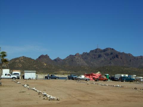
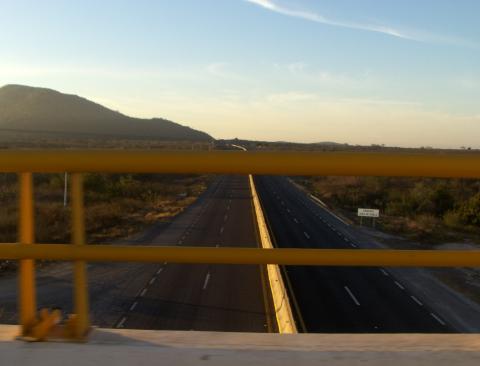
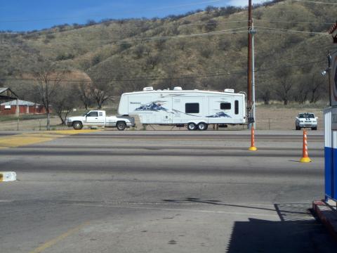
To be truthful, if you have made it south as far as San Carlos, the condition of the roads will only improve as you head farther south.  That said, we had heard reports from people that headed north ahead of us, that the road condition from San Carlos to the border was littered with huge potholes.  Apparently the word got out and road crews have filled the potholes in all but a few stretches.  It still is one of the bumpiest rides that we have experienced.

It was bumpy enough that our microwave, which sits in a rather well engineered bracket and is held on place by a frame screwed to the cabinet, showed evidence of abuse.  The frame had been jarred by the jumping microwave and snapped the plastic around the screws, leaving the screws and plastic rings in the wall and the frame on the floor.  One leg of the microwave was sitting on top of the bracket.  The clearance is so tight that it is extremely difficult to get the oven out of its bracket when that is your intent.   We need to order a new frame to replace the broken one. 

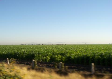
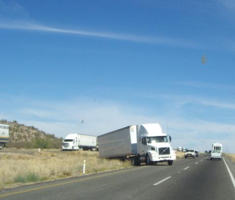
Between San Carlos and Hermosillo recent activity has closed off stretches of the road for actual resurfacing from scratch, not just patching.  From KM 61 to KM 69 was one of the largest being worked on and we shared the northbound lanes. 

We witnessed the aftermath of a truck rollover in the southbound lanes.

aa-accident1.jpg

aa-accident2.jpg

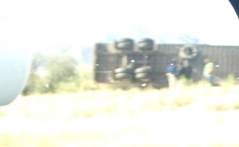
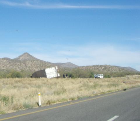
It is quite amazing the way traffic reroutes itself without the assistance of law enforcement or emergency personnel.  All of a sudden, we noticed southbound traffic heading our direction in the left hand lane.  It is really a rather efficient way to operate.  Traffic that is being blocked simply crosses the median and continues traveling until they pass the accident.

aa-accident3.jpg

We left San Carlos at 7:30 AM and by 9:30 we were approaching Hermosillo.  The traffic in Hermosillo was quite heavy but kept moving.  There is a stretch of Hwy 15 that follows city streets and there are unmarked topes (speed bumps) waiting for you.  Fortunately, we spotted them all.  There are also a few critical turns that, if missed, could cause delays.  Generally, the road is marked quite well.

The last 100 KM north of Hermosillo to the border is pretty uneventful.  There is one Mexican government inspection point that was quite busy.  Every northbound truck and all vehicles containing Mexican nationals was thoroughly searched.  Buses were emptied and cargo was examined.  They were even inspecting beneath vehicles and even dismantling areas where contraband could be stashed.  US and Canadian residents were simply waved by and around the inspection.  (A couple of days earlier we were subject to a fruit and vegetable search at the Sinoloa and Sonora border.)

 aa-mx-govt-inspection.jpg

The spot where southbound traffic stops to pick up their permits known as KM 21 checkpoint and is quite busy in the mornings, but by noon it is nearly empty.

aa-southbound-km-21.jpg

Northbound, this is the point where we turn in our vehicle permits.  It is important to do this because if you don’t, it could make it impossible to enter on a return trip.  We parked just north of the permit point so that we could cross the road to the Southbound checkpoint to go the bank to trade in our pesos for dollars.

aa-northbound-km-21.jpg

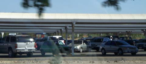
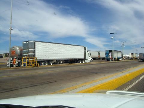
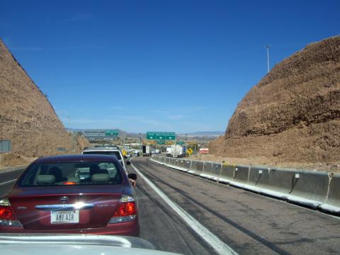
As we approached the border, we came up over a rise and were greeted by a line of stopped vehicles on the downhill side.  Reduce speed when within a few kilometers of the US custom and immigration checkpoint.  There are truck lanes and auto lanes.  If you are in an RV, be sure to get into the auto lanes.  Signage will eventually get you in the proper lanes.

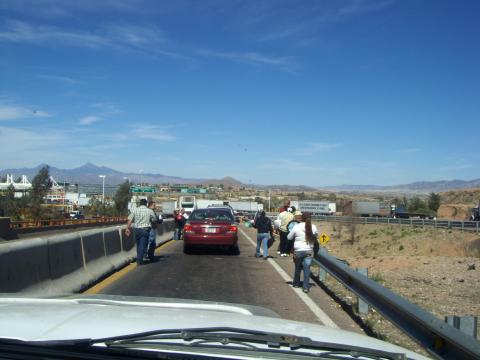
This picture was taken when we got into line at the border.  From this point, it took two hours to clear immigration and customs.

aa-us-customs-2-hours.jpg

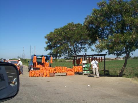
Guess what we encountered next, yep you got it, more vendors.  Unlike the beach vendors, these vendors realize that they only have one chance at you and are a little more aggressive.

aa-us-customs-vendors1.jpg

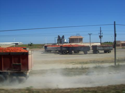
This continued all the way to the border. 

aa-us-customs-vendors2.jpg 

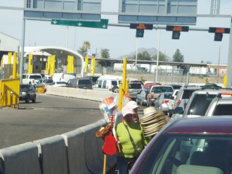
We only opted for a windshield wash.  We picked a guy with both a soap bottle and a rinse bottle.  He did an excellent job.

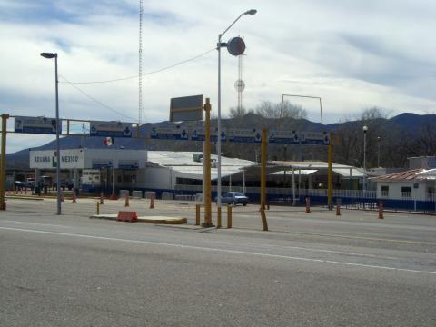
Once we reached the checkpoint, immigration was a snap.  We were directed to head to a customs waiting area for inspection.  We were, of course, truthful and mentioned our two bottles of tequila.  Since our refrigerator was broken, we didn’t have to worry about much in the way of food, but did fess up to having some eggs.  The inspector peered into our warm refrigerator and ignored the few cans of beer and snagged our eight eggs.  By the way, fines begin at $300.00 for contraband items, if they find them and you didn’t declare them.

After two hours, most of it in line, we were on our way toward Tucson and smooth roads.

We spent our first night back at the DeAnza Trails RV Resort near Green Valley, just south of Tucson.  We had made our reservations online and check-in was a snap.  We would recommend this stop.  For some reason, the water hookup is on the wrong side of the rig, but well within hose reach.

Northbound to San Carlos

Thursday, March 13th, 2008


We are in San Carlos, Mexico, which is a coastal neighbor of the city of Guaymas.  We are doing several things now that we haven’t done in a long time.  First, we are watching TV on our own TV set.  We haven’t had TV since we left Sayulita and that was only because we were hooked up to some friends’  TV.  The one good thing about not having  TV is we haven’t been bombarded with politics and all the talking heads.  We certainly did not miss that.  Second, we have our furnace on to get the morning chill out of the air.  All we have used in the last few months is an electric heater early in the morning.  Hope we don’t have to use it very often in the next few months.

Our drive north from Lo De Marcos was uneventful, thank goodness.  Our blog a few days ago mentioned the 3 different highways to leave the Puerta Vallarta area.  We went with our first choice.  We went up the curvy, hilly Highway 200 for about 40 miles/ 60 km.  We left on a Sunday having heard no 18 wheelers would be on the road.  WRONG!!!    There were some coming around every turn and driving on the middle line. We turned off at Compostela and got on the toll road.   The road was not much different than Highway 200, still curvy, and steep but without the jungle vegetation.  This really made a difference as we could see where we were heading and see traffic coming towards us up ahead.  We traveled about 35 km and then got on the toll road to Tepic.   We must have taken a wrong turn because all of a sudden we were driving right beside the real toll road.  We were on the libre (free) road.  The only difference is we had more truck and car traffic and possibly smaller shoulders. Both roads merged  together near Tepic.  After we left Tepic the toll road was GREAT.   We were on a 4 lane road.  Well, not exactly!  Instead of 2 lanes in our directions we had what MX  likes to build, a 1 and 3/4 lane road.   We made good time because  of the fairly smooth road.  We stopped for the night about 45 miles north of Mazatlan at the town of Celestino Gasca.  (See last posting for information on Celestino)

After passing through Mazatlan we got on a real  4-lane, divided, toll road to Las Mochis.  Really quite nice.

a-from-overpass.jpg

We had a long (500 miles) drive ahead of us with San Carlos, MX as our destination for next night.   We had planned on getting up at 5:30 AM but our alarm rang at 4:30 AM and we had a leisurely morning until our departure at 6:30 AM.  We don’t normally try to cover that much territory in a day, even in the US.  This was our longest travel day ever.  We arrived at our destination about 3:30 PM.

The state of Sinaloa covers an area from south of Mazatlan to just north of Los Mochis.  It is an incredible agricultural area.  Looking at all of the corn, you might think you were in Iowa, except for the mountains in the background.

a-corn.jpg

These huge screen tents are covering acres of tobacco farms.  About every 100 yards there is a door that allows people to enter and exit.

 a-tobacco.jpg

The foliage along the road in Sinoloa was beautiful.  The bougainvilleas have become our favorite shrub.  They are magnificent in spots.  It makes a gorgeous wind break.

a-bug.jpg

Along the road and at the some of the toll plazas, the stunning decoration is rows of trees with gorgeous orange leaves.  Sorry we don’t know the name of this tree.  Please comment if you know.

 a-trees.jpg

Due to their extended growing season, I’m sure that they can have multiple growths of crops and spread out the planting to ease the picking.  We saw corn growing in various stages of maturity.  Tomatoes were being picked and the oranges were also ready.

a-oranges.jpg

Heaping truckloads of tomatoes.  Not all of them made it to the processing plant.  We followed a 30 mile trail of tomatoes dropped occasionally from an overloaded truck.

a-tomatoes.jpg

Cemeteries were found at frequent intervals along the road.

a-cemetary.jpg

Once we passed the town of Los Mochis, at the north end of the state of Sinoloa, we headed into the state of Sonora.  This state goes all of the way north to the Arizona border and is mostly a scrub brush desert.  As soon as we entered the state of Sonora, the condition of the roads significantly degraded.  Basically, the roads had long, rough stretches of  repaired pavement and the shoulder all but vanished.  This is toll road.

It is not uncommon to find tractors and other farm implements on the toll road in Sonora.  They are not allowed in Sinoloa.  Here are some cowboys herding cattle on the edge of the toll road.

a-cows1.jpg

Some cattle graze alongside the road without the benefit of a cowboy present.

a-cows2.jpg

Our day’s destination of San Carlos is situated about mid-way to the Arizona border from Los Mochis.  We arrived at the Totonaka RV Park at about 3:00 PM.  The park is quite full.  The spaces are all back in and a little on the slim side.  As we discovered on our trip down, the park voltage gets extremely high, about 134 volts, late at night when energy use is low.

We plan to leave here on Thursday and head to the border entering at Nogales, AZ.

San Carlos to Huatabampito – November 1, 2007

Friday, November 2nd, 2007

Well, we thought we would make a short day of it and go about 150 miles from San Carlos to Huatabampito, which has been described as the best place to camp on the beach.  We are mid-way between San Carlos and Los Mochis and about 30 miles off the highway right on the beach.

The trip was pretty uneventful for most of the day. We saw sights such as large beer can sign along the road.

a-large-beer.jpg 

Things were going well and we decided to stop in Cd. Obregon at Wal-Mart to stock up on a few things.  At one intersection we had Wal-Mart, Sam’s Club and Home Depot.  The main difference between here and the states is that the parking is covered.

Covered parking at Sam’s

 a-covered-parking-at-sams.jpg

Covered Parking at Walmart

a-covered-parking-at-walmart.jpg

Later, we reached the towns of Navojoa and Huatabampo.  Both towns were quite modern and prosperous looking.  As luck would have it, the road to Huatabampito was under construction and we made a slight detour through the center of town.  Ignoring Tinka’s insistance to ask for directions to make sure that we were on the correct road, we continued south.  Unfortunately, the road we were on ran parallel to the correct road.  When we reached the end of it, it turned to dirt.

Luckily, a man with three kids in his pickup agreed to lead us back on track.  We made a u-turn and followed.  He turned right onto a dirt covered bridge that was supported by cement pillars.  We followed.  As we made the turn, the right hand trailer tires got too close to the edge of the bridge and the dirt crumbled underneath.  We neglected to take a picture, but it wasn’t pretty.  The trailer was leaning over the canal at about a 60 degree angle.  The back rear corner of the trailer was touching the roadway.

Along came a guy with a tractor and with the help of a chain we have, was able to assist us in backing back onto the road.   We drew quite a crowd as everyone wondered what these gringos were doing here in the first place.  They were all fantastic and helped where they could.

We finally crossed the bridge and were back underway in 15 to 20 minutes.

Another 20 minutes and we were at our destination.  This place is quite unique in that the RV sites are directly on the sand.  We have good power, 30 amp, and Wi-Fi.  They have a restaurant that gave us the first margarita free.  We’re paying $15.00 per night and will be leaving here Saturday, Nov. the 3rd.

Currently, we are the only visitors, but the place will be full in another month.  Here’s our spot.

 a-campsite.jpg

And the view from our trailer.

 a-view-from-trailer.jpg

Here are some other sites that are a little closer to the water, but the sand is a little softer.

 a-other-campsites.jpg

We’ll be moving toward Mazatlan tomorrow which is about 350 miles.

Life’s a journey, sometimes scary!!!!!!!!