Archive for the ‘Illinois’ Category

Rockford, Illinois — Home Sweet Home

Sunday, July 26th, 2009

Click for Rockford, Illinois Forecast

After several years absence, we have finally returned to Rockford, Illinois, Rick’s hometown, for a very brief visit

It is funny how you can breeze past things and years later, when you spot them, there is finally meaning in what you see.  A sign caught my eye as we drove passed a park on the SE part of town. It was a sign on a ticket booth for the Rockford Peaches, a girls professional baseball team that competed here from 1943 to 1954. The were depicted in the movie “A League of Their Own”.  (Click on Photo to enlarge sign.)

peaches.jpg

We moved to Rockford in 1953 when I was 7 years old. We never made it to any of the games.

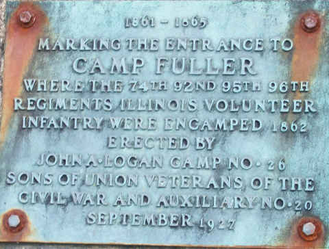
Zipping through town we headed over to my childhood neighborhood.  On a corner of the block upon which we lived I spotted this plaque indicating that my old house,  was built upon part of the site of Camp Fuller, an encampment for Union soldiers during the Civil War.  Looks like they should have used brass bolts to keep the rust down.
fuller.jpg

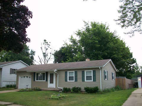
This is the 1st house that I owned. I had it built in 1968.  Note the huge oak tree in the back yard. I planted it as a sapling when my first son Marc was born, in 1970.
winters-drive-480.jpg

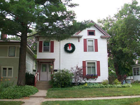
The last house that I owned in Rockford was one that was built back in 1850.  I may have put the still decorated Christmas tree away in the attic at the end of one holiday season, but not even I would leave a Christmas wreath on the house at the end of July.
clinton-480.jpg

(That should drive our friend Karen, head of the X-MAS decoration police, to go have a drink.)

We had a wonderful dinner with an old friend at the famous Maria’s Italian Cafe. There were several old friends that happened by the restaurant that evening.  Most of them were contemporaries of my late brother Bob.  They remembered him fondly.

Just a final note regarding the condition of the Rockford Streets.  They are horribly maintained.  A little blacktop would do wonders.

The Quad Cities

Friday, July 24th, 2009

Click for Davenport, Iowa Forecast

We’ve thawed out from the record setting low temperatures in the Quad Cities to continue with our investigation of the area.  The Quad cities consist of Rock Island, Moline, Davenport and Bettendorf  which are in the states of IL and IA.  We saw a sign welcoming us to East Moline, IL. which claimed to be part of the quad cities, but what would it then be called, the Pent Cities?

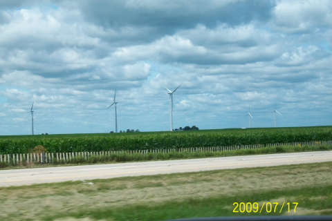
On our way through the countryside heading in to town, we spotted a lot of corn and a windmill farm that appeared to be out of place.

zz-windmills.jpg

Anyway, we wandered up and down the shore of the Mississippi on both sides.

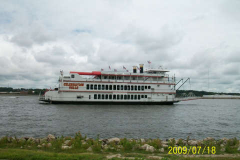
We spotted a river boat, the Celebration Belle, that gives tours from Moline to as far away as southern Minnesota.

zz-boat1.jpg

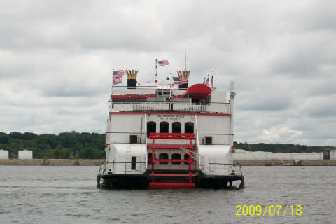
You can tell by the size of the paddle wheel that it is only for show.  As a matter of fact, it doesn’t even touch the water.

zz-boat2.jpg

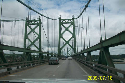
There are several bridges across the Mississippi in the area.  Most have very narrow lanes.

zz-bridge.jpg

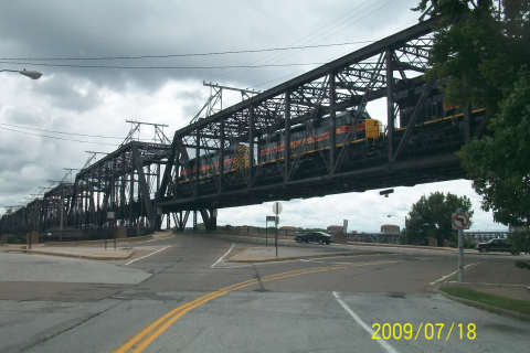
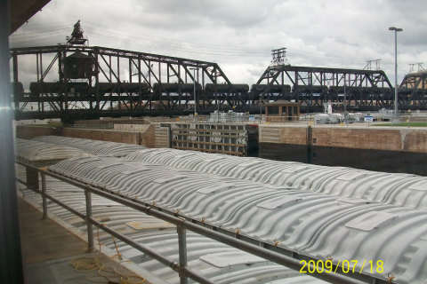
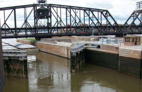
The bridge across the river near the Rock Island Arsenal is a multi-layered, multi-use structure.  The top level is for trains.

zz-bridge2.jpg

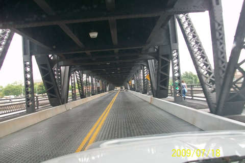
The lower level is for auto traffic.  It is not for claustrophobics, especially with a 3-engine freight train rumbling overhead.

zz-bridge3.jpg

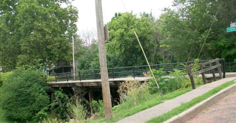
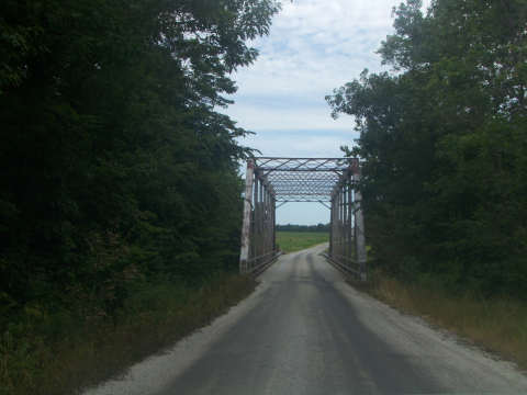
While on the subject of bridges, here is a wooden bridge that is still being used for motorized traffic. There are no signs restricting the weight of the traffic.  We elected not to cross this one.

zz-bridge4.jpg

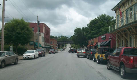
There is something about a river town that is unique. It’s great to see communities where all of the old buildings are still in use.

zz-town.jpg

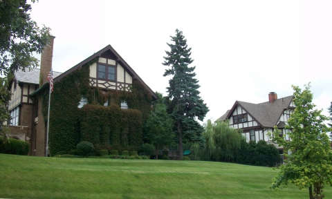
Having grown up in old houses and owned one myself that was built in 1850, I love to see these fantastic old homes.  These people are really into vines.  I don’t know what it has done to the mortar.

zz-house1.jpg

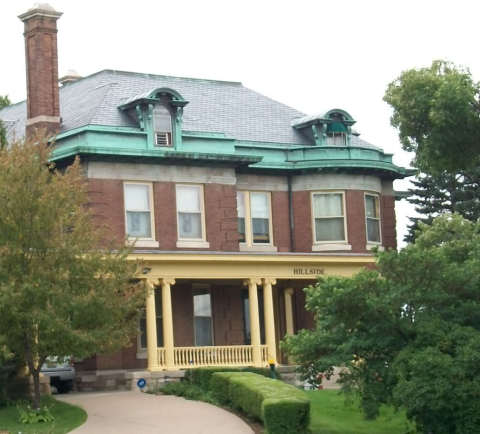
Some homes even have names.  This one is named Hillside.

zz-house2a.jpg

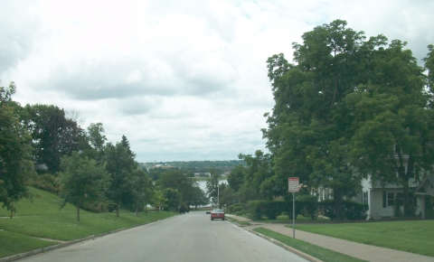
The neighborhoods along the river are built on a fairly steep hill.

zz-house3.jpg

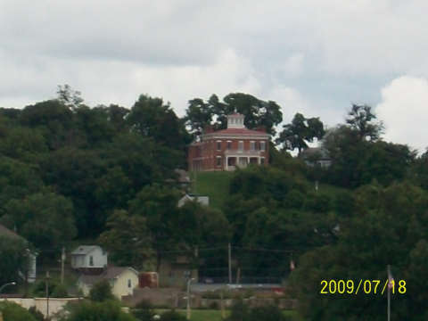
What do you think of their view of the river?

zz-house4.jpg

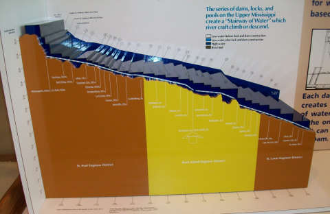
The graphic below demonstrates the 400-foot drop in elevation of the upper Mississippi River between Minneapolis and St. Louis. (Click on photo to enlarge)

zz-river480.jpg

The level is controlled by a series of locks and dams.  The largest drop is the one of 49 feet.

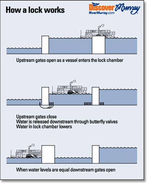
The lock system works on gravity, the lock is filled from water from upstream then released downstream to lower the level.

zz-how_a_lock_works.jpg

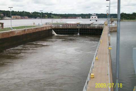
A group of barges on a downstream voyage wait for the water to fill the lock.

zz-dam1.jpg

Once the water level above the dam has been reached, the gates open and the barges move into the lock.

zz-dam2.jpg

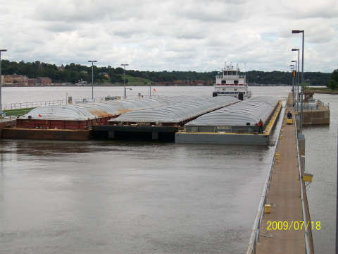
Once in the lock, there are only a few feet one each side of the barges.

zz-dam3.jpg

When the lower level is reached, the downstream gates are opened, the barges move out and the gates re-close.  The entire cycle can take as little as 20 minutes.

zz-dam4.jpg

While in the area we checked out the Jumer’s Casino in Rock Island.

zz-jumers.jpg

It wasn’t as profitable as the River Queen in St. Louis, but we at least broke even.  The lunch buffet was excellent and quite reasonable.

The Land of Lincoln

Wednesday, July 22nd, 2009

Click for Springfield, Illinois Forecast

Just a note about Illinois roads, they don’t always mark the clearance under the bridges.

a-bridge.jpg

So far, we noticed that they do post heights less than 15 feet.  When you’re rig is nearly 13 1/2 feet tall, the more information that you have, the better.  Also, be sure to slow down in the construction areas.  The fine for speeding is $375.00 and if you happen to hit a worker, 14 years in jail.  That would really mess up your trip.

The capital of Illinois is Springfield, a city of about 116,000 people located in central Illinois.  Their current Capitol building looks like most, with its large dome.  Here is a picture of the old Capitol building, with its weather worn columns, which we found a little more interesting.

z-old-capitol.jpg

Aside from governmental activities, Springfield is all things Lincoln.  You have the Abraham Lincoln Presidential Library, Lincoln’s residence, Lincoln’s neighborhood, the Lincoln Museum, Lincoln’s church and I’m sure his outhouse is there somewhere.

Anyway, we went into the Lincoln Presidential Library, which is the newest of all presidential libraries, built in 2002.

z-library.jpg

Unless you are there to do research, there isn’t much to see. The library does, however, have a lot of online resources available for the public.

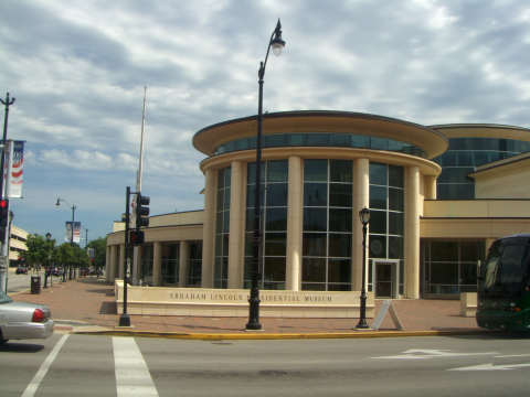
We crossed the street to the Lincoln Museum, which is a mirror image of the library.

z-museum.jpg

Inside, and after a nominal charge, we sat through an interesting historical, holographic presentation and then started through the exhibits.

They had wax figures of many key figures of Abe’s life and times.  Here is the family in the central plaza of the museum.

z-lincolns.jpg

Abraham and Mary Lincoln had four children, three of which died at an early age.  The fourth, Robert, lived until 1926 and died at the age of 82.  I’m not sure he was a favorite child, for he tried to have Mary committed to an asylum.

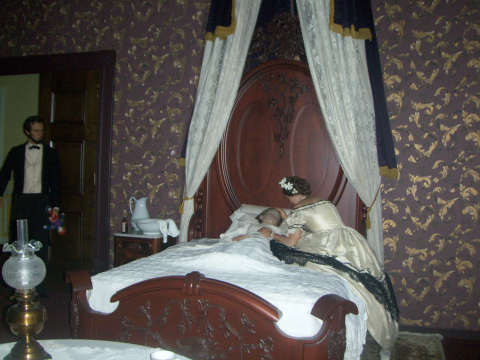
Depicted in wax, this is the White House death bed of one of the children, while State entertainment was taking place in another room of the mansion.

z-child-death.jpg

There were some great displays in the museum.  The old log cabin, the White House Years, the Civil War, the assassination, and many others.  The many documents and other treasures were all were very interesting.

A few blocks from the museum and across the street from the old Capitol building was Lincoln’s law office.

z-law-office.jpg

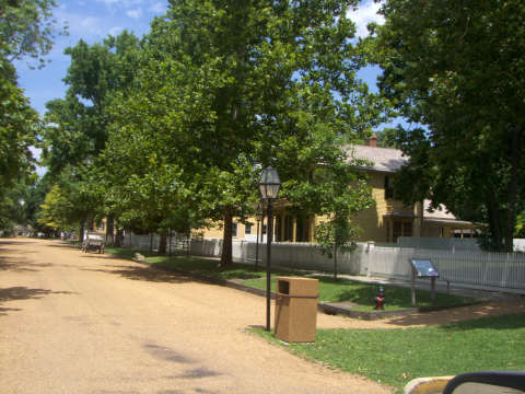
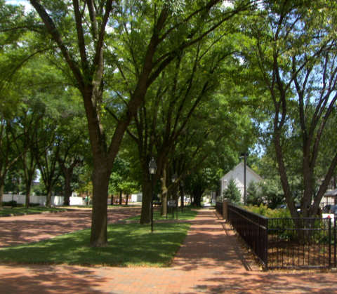
We ate lunch across the street at one of several sandwich shops along the way. Then headed to the old neighborhood.  Lincoln’s home and surrounding area have been restored to represent Abe’s neighborhood.

z-neighborhood.jpg

The last time we visited here, 20 years ago, archeologists were digging up the back yards of the neighborhood hunting up any relics of the period.

z-neighborhood2.jpg

Because we had done it years earlier, we didn’t take a walking tour of the neighborhood.  If you haven’t done it, your time would be well spent to investigate the tour.

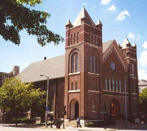
We headed on passed Lincoln’s family church …

z-church.jpg

Then we headed over to Best Buy to pick up a camera to hold us over until ours could be repaired. (See earlier camera story.)

Then it was on back to the Sangchris Lake State Park.   The park is nice and quiet, about 15 miles southeast of Springfield.  They offer campsites with 30 amp electric but no water or sewer.  We used our fresh water tank and dumped our sewer at the dump station they provided.

Here are the first two pictures with the new camera.

z-state-park1.jpg

z-state-park2.jpg

When in the Springfield area, be sure to take in some of the history.

Frozen Keisters and Camera Problems

Saturday, July 18th, 2009

Click for Erie, Illinois Forecast

Jumping a little ahead of a couple of stories, Last night we were just east of the  Quad Cities of Rock Island, Moline, Davenport and Bettendorf  which are in the states of IL and IA.  (This is the place where the Rock River merges with the Mississippi.) We froze our butts off and had to turn on the furnace. It was a new record low.  It must be time to head back south, but that day still lies about a month away.

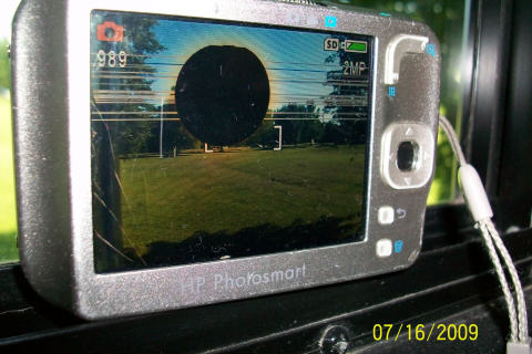
About two weeks ago, I dropped the camera and now the screen looks like this.

z-camera.jpg

The last few reports were published (and the next two) with pictures from this camera.  It’s tough to just point and not know what you are shooting at.  Sometimes you get lucky, other times not.
I can’t believe it, but when we purchased the camera back in March of 2007, we had the foresight to purchase a 4-year repair or replace policy on the camera.  We have to be in the general vicinity of the store for a couple of weeks while they process the replacement.  Therefore, we’ll have to wait until we get back to Texas to deal with it.

That poor camera has been through the works and has held up well through the over 12,000 pictures that we have taken with it.

In the meantime, I purchased a Kodak EZ Share camera to tide us over until we have our other one fixed.

Cahokia Mounds

Friday, July 17th, 2009

Click for Cahokia, Illinois Forecast

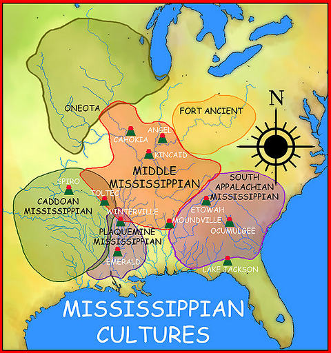
It’s amazing what you just come across on your travels.  Located just across the Mississippi River from St. Louis, the Cahokia Mounds is a well kept secret.  There is a very informative “Interpretive Center” on the grounds.  Between about 650 and 1400 AD, a prehistoric city of up to 20,000 Native Americans from the Mississipian Culture was established.

563px-mississippiancultures_map_hroe_2008-480.jpg

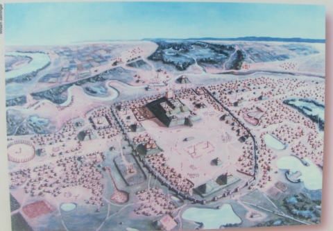
This is a drawing of the city based on the archeological digs at the site.

cahokia1.jpg

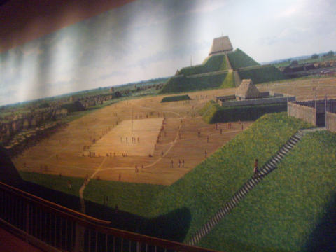
The main structure, Monk’s Mound, is 92 feet tall and is the largest earthen mound in the Americas.  The Cahokia site is the largest site north of Mexico.  This photo of a mural on the wall of the Interpretive Center shows Monk’s Mound with its temple and game fields.

cahokia2.jpg

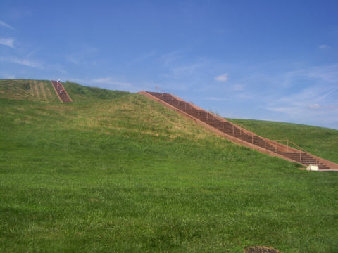
It probably won’t surprise anyone when I say that I opted out of climbing the steps on Monk’s Mound.

cahokia3.jpg

There are several shapes for the mounds.  This dome shape indicates a burial mound.

a-burial-mound.jpg

The leaders, or chiefs, were housed in the temples or other structures on top of the flat topped mounds.  The head chief lived atop Monk’s Mound so he could oversee the entire community.