Archive for August, 2010

Fort Davis and the Davis Mountains

Sunday, August 15th, 2010

Click for Fort Davis, Texas Forecast

Tinka’s been trying to get Rick to the Davis Mountains ever since their marriage.  Her first visit to the area was when she was an infant, many years ago.  Her family would come here every year for vacation. More about that later.

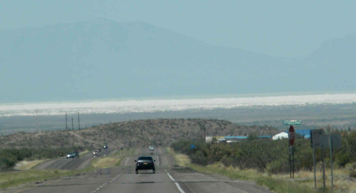
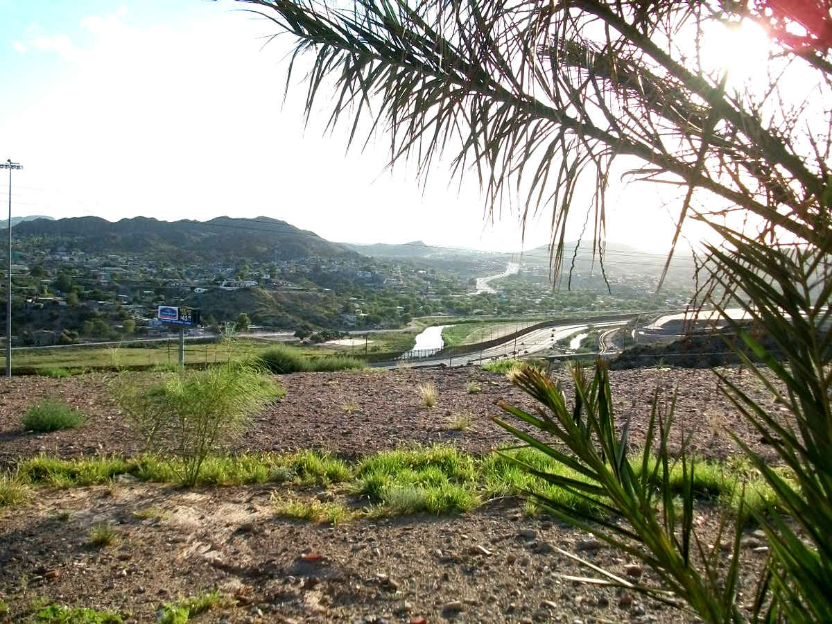
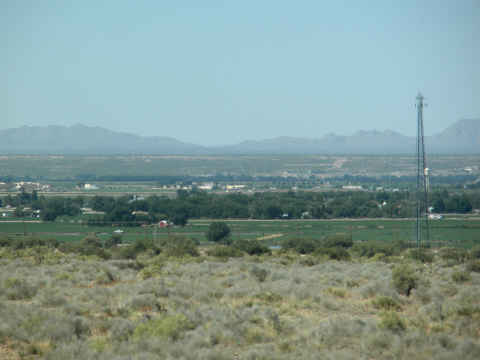
Rick, a confirmed flat lander, has resisted until now.  Since we were going to be traveling back to the Rio Grande Valley from El Paso on I-10, our path carried us too close to the mountain range for any excuses to work.  As we traveled east from El Paso, farmland and the Rio Grande, marked by the row of trees, were just south of us.  The mountains beyond the river are in Mexico and seem to be endless.

rio-grande.jpg

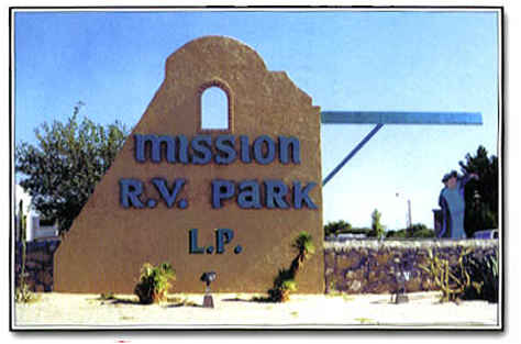
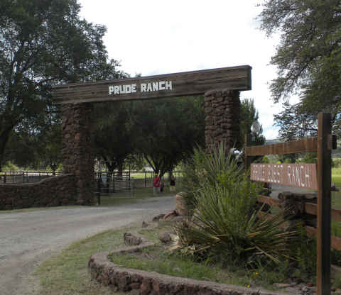
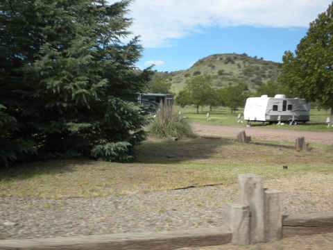
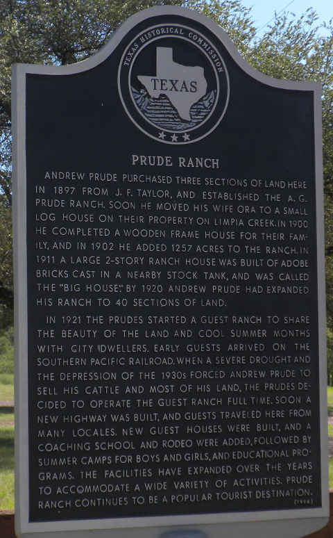
When we travel, the discount RV park directory from Passport-America is our choice.  When checking out the Fort Davis area, we came across the Historic Prude Ranch.  The ranch is a dude ranch tailored to more youthful guests than us.  They have two areas for RVs.  We chose the one located on an upper level of the grounds, farthest from the farm animals and their flies.

prude-ranch-gate.jpg

We were only going to be here three nights, so we didn’t get a chance to use many of their facilities.

prude-ranch-1.jpg

prude-horses.jpg

Here’s one of the other rigs that happened to stop by at the ranch.

prude-ranch-trailer.jpg

The Prude Ranch has been in business for 113 years  and they have operated the dude ranch for about 90 years.

prude-ranch-hist-mark.jpg

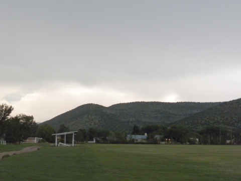
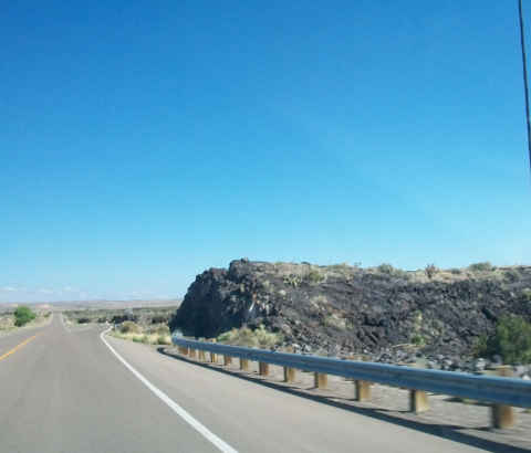
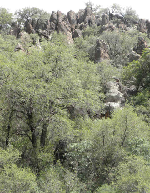
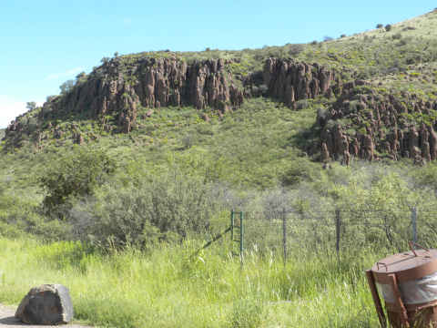
Finally, Rick finds a mountain range that he likes.  The Davis Mountains are entirely within the borders of the state of Texas.  They were formed from volcanic action that centered close to nearby Marfa, TX nearly 65 million years ago.   The rock formations and effects of erosion are magnificent. This particular rock is located near The Lodge at the Davis Mountain State Park.

dm-rock-480.jpg

The unusual vertical rock formations are everywhere.

dm-rocks.jpg

The ridges stretch for miles.

dm-rocks2.jpg

dm-rocks3.jpg

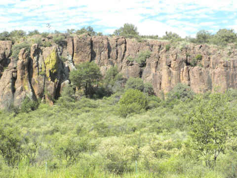
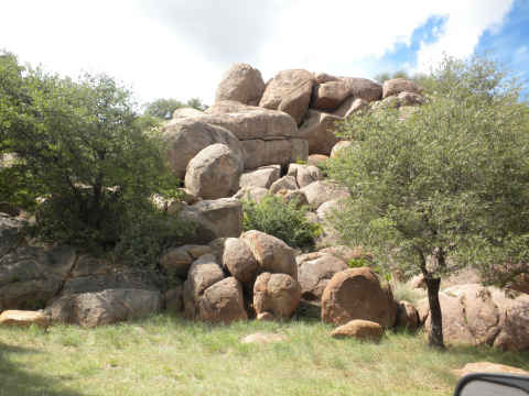
Other rock formations are similar to what we saw in the southern California mountains and the “Texas Canyon”, located just east of Tucson, AZ.

dm-round-rocks.jpg

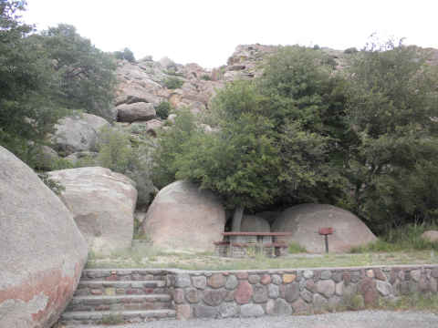
Picnic areas, here, are integrated very well into the rough background.

dm-rocks-table.jpg

From 1850 until 1875, the town of Fort Davis was the original county seat for Presido County, home of the oldest town in America, Presido.  (Presidio has been continuously inhabited since about 1500 BC.)

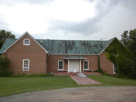
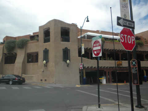
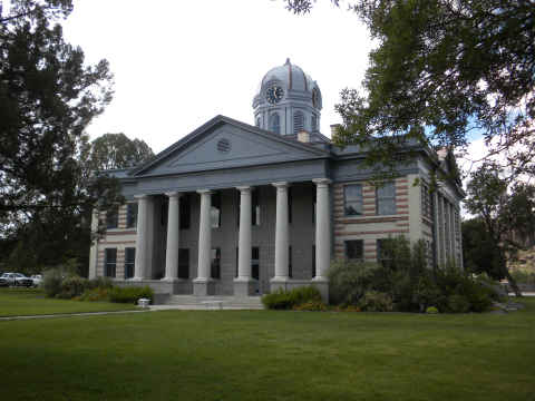
But I digress, the counties were reconfigured and Fort Davis is now the county seat of Jefferson Davis County.  The county courthouse has been maintained beautifully, with some newer facades.

courthouse-fort-davis.jpg

The entire county has only a about 2500 people.  One of them is a night police officer that thinks that 3 miles per hour over the posted limit is actually speeding.

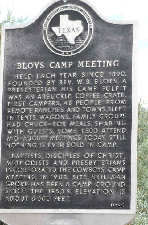
Now, back to Tinka’s early vacations.  Since before Tinka was born, her parents, aunts, uncles, and cousins would find their way to the Davis Mountains for a week each August.  Their destination was the Bloys Camp Meeting where four protestant  church denominations have been holding these gatherings since 1890.

bloys-camp-meeting-hist-sign.jpg

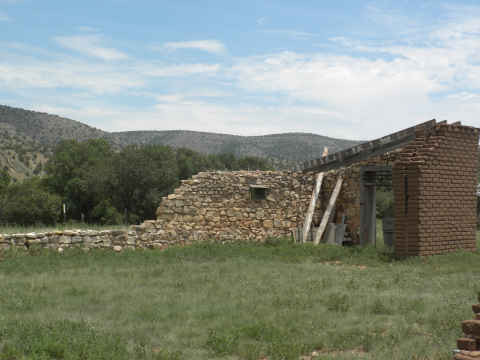
Apparently, the original visitors to Bloys used to stay in tents or other temporary structure.  Some sixty years ago, Tinka’s father decided to build a cabin constructed from corrugated tin.  Nestled back against the boulders, it became Cabin No. 1.

cabin-1.jpg

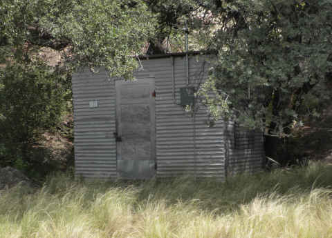
Now there are about 450 cabins, still nearly all made of tin, but many have satellite TV.  They seem a little extravagant for only one week per year.   Permanent residence is not allowed.

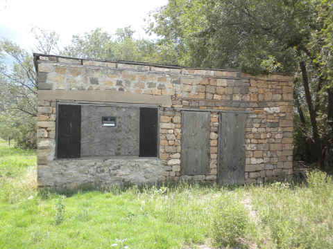
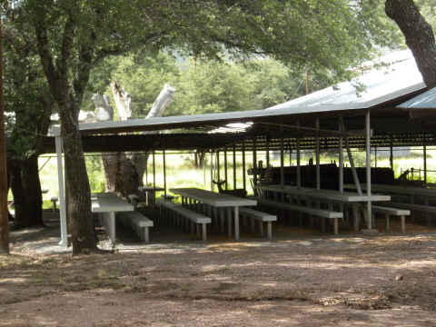
Here is one of several cooking sheds that service the huge crowd.

dining-hall.jpg

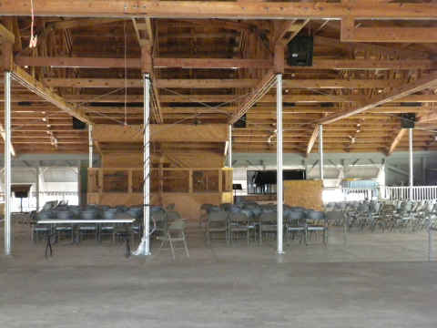
This tabernacle houses the four daily worship services.

tabernacle.jpg

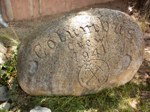
A monument has been erected to honor the memory of one of the founders of the Bloys Camp Meeting.

We’ll be making trips to the McDonald Observatory and also see if we can spot the mysterious Marfa Lights.

Back to Texas

Saturday, August 7th, 2010

Click for El Paso, Texas Forecast

Well, time came to swap one mountain range for another.  As we left Ruidoso, NM and headed past Mescalero to Alamogordo, we spotted what looked like low hanging clouds.   (Click on photo to enlarge)

1a-white-sands-480.jpg

It turns out that these are not clouds, but the White Sands Missile Monument, home to the White Sands Missile Range.

Only about 3 hours from Ruidoso is our next stop, El Paso, TX.  We’re here to spend a few days to catch up with Tinka’s lifelong friend, Sherri. The downtown area looks good with a sky that is this blue almost every day.

1a-downtown.jpg

As we usually do, we set up at the Mission RV Park.  Usually the park is packed, but this time it was less than 50% full.   The park is very well equipped.  We used Passport-America discount.

1a-mission-rv.jpg

We headed over to the western portion of El Paso where we were able to catch an afternoon view of the Rio Grande and I-10 as it heads into New Mexico. (Click on Photo to Enlarge)

1a-river480.jpg

Here’s a peek into UTEP’s Sun Bowl.

1a-sun-bowl.jpg

On the way back to the RV park, we had the opportunity to take this evening shot of El Paso and its much larger neighbor, Ciudad Juárez, Mexico, in the distance.

1a-night-shot-480.jpg

We had a nice visit with Sherri and had the opportunity to see how grown up her granddaughters are getting.

1a-pool.jpg

We are leaving here to spend a few days in our next mountain range, the Davis Mountains of West Texas.

Another Side Trip – To The Old West

Wednesday, August 4th, 2010

Click for Ruidoso, New Mexico Forecast

We had been looking forward to a visit from our Arizona friends, Karen and Roland.  They had just returned from Europe and upon their return, headed out on the 400 mile journey to Ruidoso.

During their brief visit, we decided to take a side trip through historic Lincoln County, NM and the towns of Capitan, NM and Lincoln, NM.   But first, breakfast.  We highly recommend the Cornerstone Bakery in Ruidoso.  They have a wide range of great tasting breakfasts on their menu.  Parking a large pickup in their lot can be a problem because they are quite busy.

(CLICK ON PHOTO TO ENLARGE)

capitan-side-trip-map-480.JPG

Our first “stop” was the town of Capitan, best known for being the birthplace of Smokey the Bear.

smokey-bear.jpg

A vote was taken in the car and the decision not to tour the Smokey Bear Museum prevailed.  I’m certain that it would have been fascinating.  So, off to the town of Lincoln we headed.

Lincoln is an extremely well preserved old west town and famous for several of its residents and the Lincoln County War.  The war was a skirmish over control of the dry goods and cattle industries in the area.  Merchant LG Murphy and cattleman John Chisum were key players.  The war claimed a total of 22 killed and 9 wounded.

The appointment of Pat Garrett was named county sheriff.    He and his men hunted down and dispatched participants in the skirmish.  The famous outlaw, Billy the Kid was one of these participants and was killed by Garrett in July of 1881.

The buildings in the area were quite interesting.  The wide range of construction techniques is amazing.  Here is the Torreon tower that was used as defense against the Apache Indians.

torreon.jpg

Karen, coming around the building, helps give perspective to the tower size.

torreon2.jpg

Looking at the inside, it was pretty tight living conditions.  It also seems that if the Indians were patient, the place would be a death trap.

Other stick and mud structures, called jacals, were used by early settlers in Lincoln.

jacal.jpg

jacal3.jpg

Some structures were a combination of adobe and rock.  Not all of these structures have held up to the elements.

stone-adobe.jpg

On the other hand, many of the adobe buildings remain in pretty good shape.

adobe.jpg

Real estate opportunities abound.  How about this fine structure.

rock.jpg

The town has several signs describing historical events.  The author of these signs apparently didn’t have the best grasp of the English language, but he had a knack for turning a phrase.  I especially like, the one where Mr. Ollinger  “rushed to his death at the hands of William H. Bonney”.  (William Bonney is the real name of Billy the Kid)

wortley-hotel.jpg

A more modern side note involves the Columbus Rock.

columbus-rock.jpg

The 567 crew members of the SS Columbus, a German ocean liner, were detained at nearby Fort Stanton after they scuttled their ship to keep it from falling in the hands of the British in 1939.  As a token of appreciation to the residents of Lincoln, the crew carved this rock and presented it to the town.

It seems like all of the little towns along the way are home to one famous artist or another.  They are designated by “loops” that take you to their galleries.  Our journey continued with a stop at the Peter Hurd Gallery in San Patricio, NM.  Hurd is famous for his official portrait of Lyndon Johnson.

hurd-sign.jpg

Except for the Christmas lights that remain on the eaves, it is an unremarkable gallery.  The artwork inside, however, was spectacular.  There were paintings and prints by Hurd and his wife Henriette Wyeth along with paintings by several members of the Hurd family and related Wyeth family.

peter-hurd-gallery.jpg

When we arrived, artist Michael Hurd, Peter’s son, and his wife were moving several paintings to a van to take to the Inn of the Gods for a showing.  It was kind of like having our own personal moving art show.   We got a nice view as they were spirited out the door.

An avid polo fan, Peter built a polo field in his front yard.

hurd-polo.jpg

His residence was on the far side of the field.

We finished the journey by grabbing a nice lunch at Elena’s Place, a Mexican Restaurant in Ruidoso.   The food was quite good.  Perhaps a little spicy for some, but we enjoyed it.

A Side Trip To Albuquerque and Santa Fe

Sunday, August 1st, 2010


We decided to take a little side trip to Santa Fe, NM.  We were invited to a pool party in Albuquerque so we decided to combine the trips over a weekend.  The trip from southwest NM to the northwest corner was quite interesting.  Along Hwy 54 we came across massive lava flows.  It is part of the Valley of Fires Recreation Area.

1b-lava.jpg

The land is pretty flat with some hilly interruptions.  Basically the high plains, about 5500 feet altitude.

The swim party was nice, about sixty new friends welcomed us.  After a Saturday night in a hotel in Albuquerque, it was off to one of our favorite cities. Santa Fe.  We visited Santa Fe a couple of years ago and made a journal entry that can be found at http://tinka.net/2008/04/30/santa-fe-bandelier-and-taos/.

This was an extremely short visit to Santa Fe.  First stop was the historic La Fonda Hotel for their Fiesta Mexican Brunch.  We found the food to be a touch spicier than our typical Tex-Mex and our local South Texas tortillas to be  better for some reason, probably the frying method.

The La Fonda is a fantastic building.   This is the parking garage end of the building.

1a-la-fonda-parking.jpg

The front desk is an amazing bit of wood work.

1a-la-fonda-front-desk.jpg

Another wall in the lobby. The old lobby furniture is extremely comfortable.

1a-la-fonda-lobby.jpg

After lunch it was off to the central square where the Indians gather to sell their jewelry.

1a-market-place.jpg

It appears that the prices have increased by a huge margin over our short two year absence.

1a-market-place2.jpg

We found jewelry prices to be better in the stores.

Finally we walked past the fabulous Cathedral Basilica of St. Francis of Assisi.   Click on the photo of the sign to enlarge.

1a-cathedral-sign-480.jpg

Our visit came on a Sunday and the church was quite a busy place.

1a-cathedral.jpg

The other fantastic church in town is the Loretto Chapel that we wrote about in our earlier post.

We drove back to Ruidoso by a more direct route, abut 200 miles.  This was a very relaxing and entertaining weekend.