Archive for March, 2008

Northbound to San Carlos

Thursday, March 13th, 2008


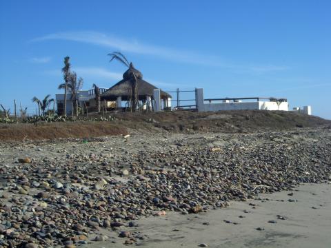
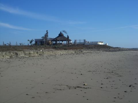
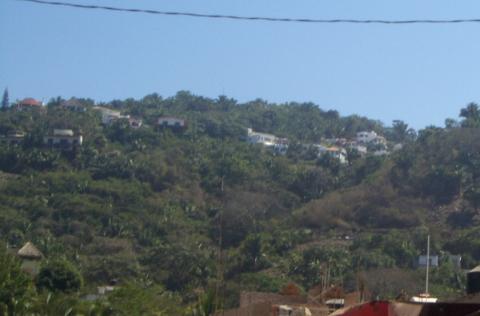
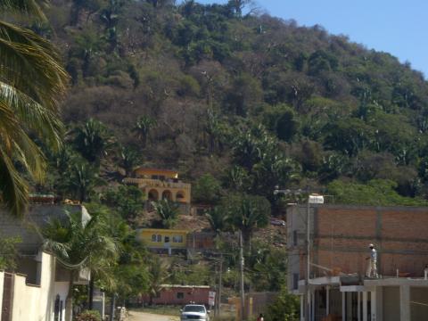
We are in San Carlos, Mexico, which is a coastal neighbor of the city of Guaymas.  We are doing several things now that we haven’t done in a long time.  First, we are watching TV on our own TV set.  We haven’t had TV since we left Sayulita and that was only because we were hooked up to some friends’  TV.  The one good thing about not having  TV is we haven’t been bombarded with politics and all the talking heads.  We certainly did not miss that.  Second, we have our furnace on to get the morning chill out of the air.  All we have used in the last few months is an electric heater early in the morning.  Hope we don’t have to use it very often in the next few months.

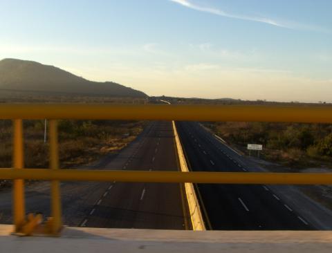
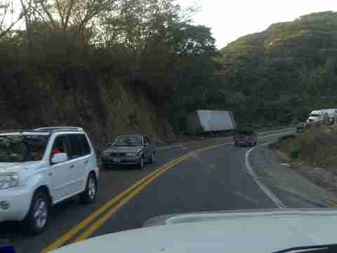
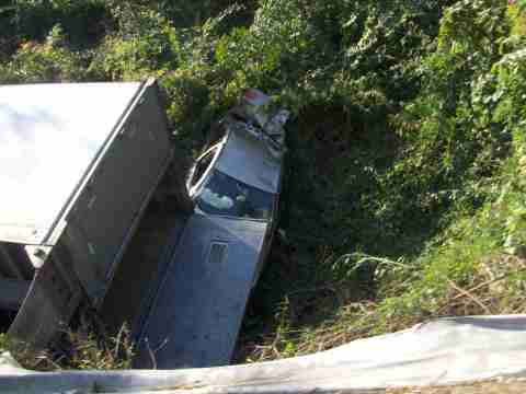
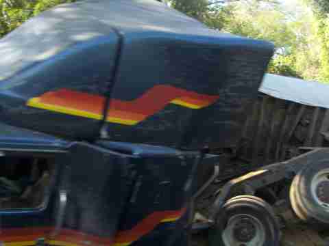
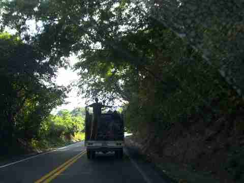
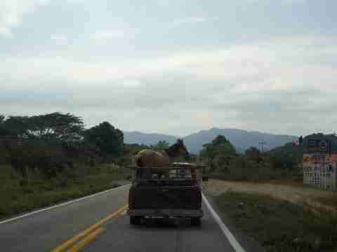
Our drive north from Lo De Marcos was uneventful, thank goodness.  Our blog a few days ago mentioned the 3 different highways to leave the Puerta Vallarta area.  We went with our first choice.  We went up the curvy, hilly Highway 200 for about 40 miles/ 60 km.  We left on a Sunday having heard no 18 wheelers would be on the road.  WRONG!!!    There were some coming around every turn and driving on the middle line. We turned off at Compostela and got on the toll road.   The road was not much different than Highway 200, still curvy, and steep but without the jungle vegetation.  This really made a difference as we could see where we were heading and see traffic coming towards us up ahead.  We traveled about 35 km and then got on the toll road to Tepic.   We must have taken a wrong turn because all of a sudden we were driving right beside the real toll road.  We were on the libre (free) road.  The only difference is we had more truck and car traffic and possibly smaller shoulders. Both roads merged  together near Tepic.  After we left Tepic the toll road was GREAT.   We were on a 4 lane road.  Well, not exactly!  Instead of 2 lanes in our directions we had what MX  likes to build, a 1 and 3/4 lane road.   We made good time because  of the fairly smooth road.  We stopped for the night about 45 miles north of Mazatlan at the town of Celestino Gasca.  (See last posting for information on Celestino)

After passing through Mazatlan we got on a real  4-lane, divided, toll road to Las Mochis.  Really quite nice.

a-from-overpass.jpg

We had a long (500 miles) drive ahead of us with San Carlos, MX as our destination for next night.   We had planned on getting up at 5:30 AM but our alarm rang at 4:30 AM and we had a leisurely morning until our departure at 6:30 AM.  We don’t normally try to cover that much territory in a day, even in the US.  This was our longest travel day ever.  We arrived at our destination about 3:30 PM.

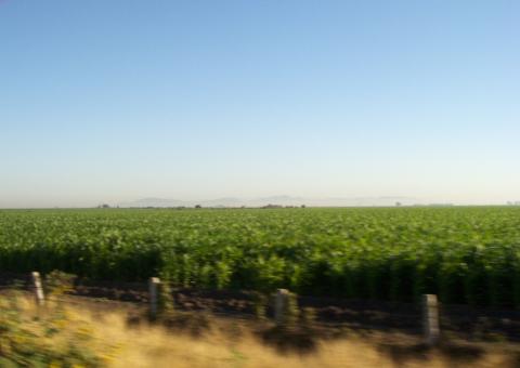
The state of Sinaloa covers an area from south of Mazatlan to just north of Los Mochis.  It is an incredible agricultural area.  Looking at all of the corn, you might think you were in Iowa, except for the mountains in the background.

a-corn.jpg

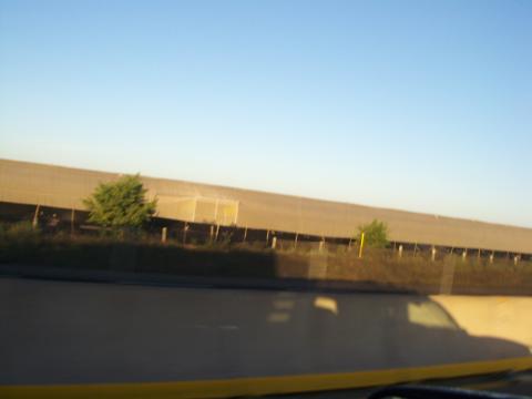
These huge screen tents are covering acres of tobacco farms.  About every 100 yards there is a door that allows people to enter and exit.

 a-tobacco.jpg

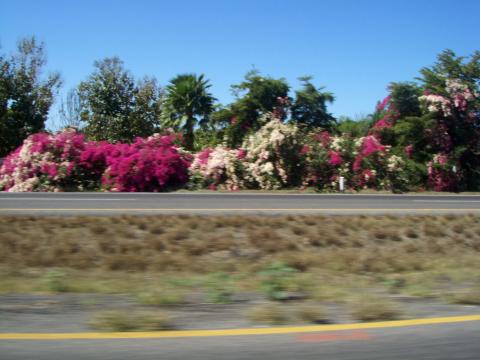
The foliage along the road in Sinoloa was beautiful.  The bougainvilleas have become our favorite shrub.  They are magnificent in spots.  It makes a gorgeous wind break.

a-bug.jpg

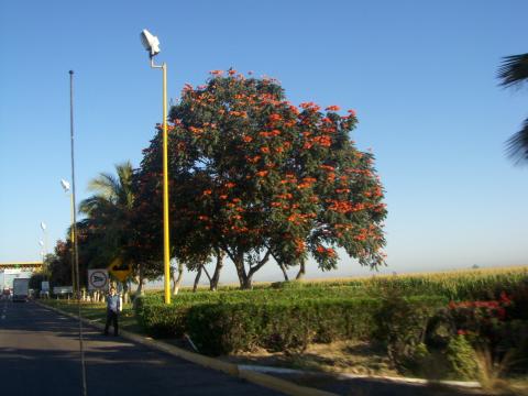
Along the road and at the some of the toll plazas, the stunning decoration is rows of trees with gorgeous orange leaves.  Sorry we don’t know the name of this tree.  Please comment if you know.

 a-trees.jpg

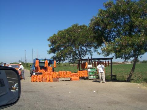
Due to their extended growing season, I’m sure that they can have multiple growths of crops and spread out the planting to ease the picking.  We saw corn growing in various stages of maturity.  Tomatoes were being picked and the oranges were also ready.

a-oranges.jpg

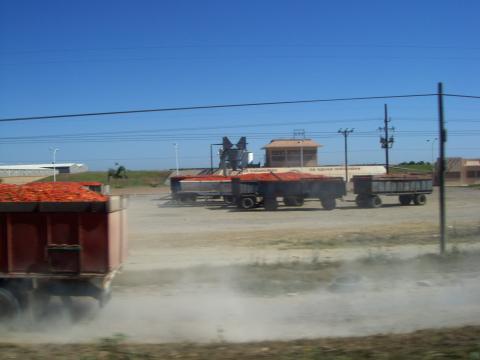
Heaping truckloads of tomatoes.  Not all of them made it to the processing plant.  We followed a 30 mile trail of tomatoes dropped occasionally from an overloaded truck.

a-tomatoes.jpg

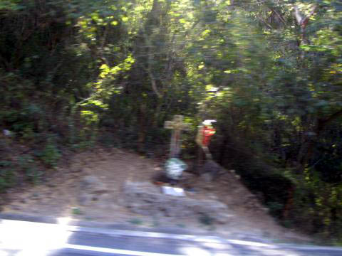
Cemeteries were found at frequent intervals along the road.

a-cemetary.jpg

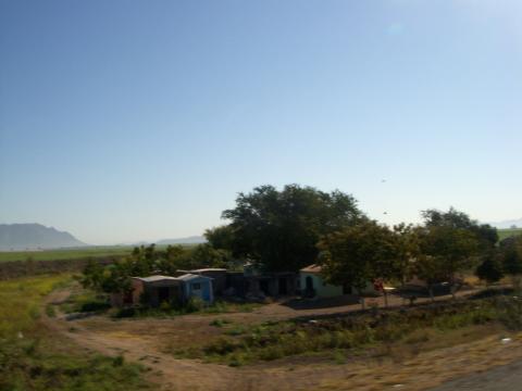
Once we passed the town of Los Mochis, at the north end of the state of Sinoloa, we headed into the state of Sonora.  This state goes all of the way north to the Arizona border and is mostly a scrub brush desert.  As soon as we entered the state of Sonora, the condition of the roads significantly degraded.  Basically, the roads had long, rough stretches of  repaired pavement and the shoulder all but vanished.  This is toll road.

It is not uncommon to find tractors and other farm implements on the toll road in Sonora.  They are not allowed in Sinoloa.  Here are some cowboys herding cattle on the edge of the toll road.

a-cows1.jpg

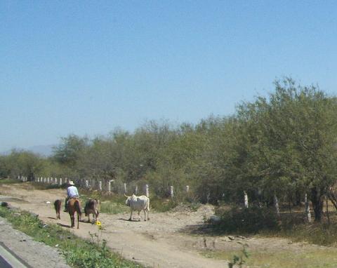
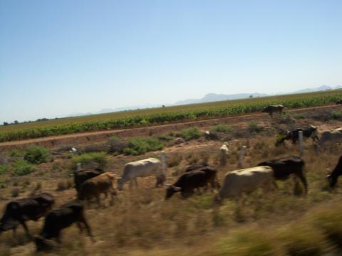
Some cattle graze alongside the road without the benefit of a cowboy present.

a-cows2.jpg

Our day’s destination of San Carlos is situated about mid-way to the Arizona border from Los Mochis.  We arrived at the Totonaka RV Park at about 3:00 PM.  The park is quite full.  The spaces are all back in and a little on the slim side.  As we discovered on our trip down, the park voltage gets extremely high, about 134 volts, late at night when energy use is low.

We plan to leave here on Thursday and head to the border entering at Nogales, AZ.

Celestino – March 9-11, 2008

Wednesday, March 12th, 2008


We arrived at Celestino RV Park at about 2:00 PM after leaving Lo de Marcos at 7:00 AM.  Celestino is about 60 KM north of Mazatlan.  There are three RV parks on the beach at Celestino; Villa Celestino, Celestino RV Resort, and San Miguel’s RV Resort.  We had reservations at San Miguel’s, but didn’t need them.  There were only two other rigs in the park.  The other two parks appeared to be almost full.

San Miguel’s is the newest of the parks, opening in November, 2007.  The facilities are quite nice.  They have free 30 AMP electrical service, Wi-Fi, beautiful palapas, showers and other amenities.

a-sm-buildings.jpg

The beach directly in front of the park has some large rocks showing in the shallow water.  The waves in this area break to the left and appear to be uniform well shaped for the surfers.

a-beach-rocks2.jpg

The beach has sand near the water but rocks are a major feature.

a-beach-rocks1.jpg

Just north of the park, the beach is less strewn with the rocks.

a-beach-rocks3.jpg

Here’s a look from the palapa at the beach to the north of the park.

a-beach-from-palapa.jpg

It seems that, judging from the slim crowd, it appears that San Miguel needs to do a little more PR to build clientele.  Because of the amenities, we think that this park will soon become the most popular in the area.  One point, they turn the water pump off at about 11:00 at night and it gets turned on when the caretaker gets up in the morning.

Tips on getting there:

Take exit at KM 78 and follow the paved road through town toward the ocean.  Watch for topes!!  There are three in the town and they are substantial.  Once you cross the railroad tracks, turn left on the dirt road and head south.  At the time that we arrived, the road was a washboard.  Continue for a few kilometers passing Villa Celeste RV park and the next park (about another KM) is San Miguel.

The park can also be reached by the exit at KM 75 if you are southbound, but the route is a little more convoluted, but less washboard.  Slow down at overpass and go past it.  There are three possible places to exit.  The third looks like a wide pullout which will allow you to get to the road that is just to the south.  Follow the road toward the ocean and cross under the railroad tracks.  The clearance is about 17 feet.  Turn right after the tracks and head north.  San Miguel is the second park on your left.  DO NOT TAKE EXIT 75 FROM THE SOUTH because the cattle guard is out. (SEE COMMENTS FOR CURRENT UPDATES Jan-2009)

ONE YEAR ON THE ROAD, March 9, 2008

Monday, March 10th, 2008


We sold our stick house in Weatherford, Texas 17 months ago.  Retirement came a few months later and a year ago on March 9, 2007 we left the Dallas area and started on our journey.

We started out on our trek heading west toward California and ended our first year on the Mexican coast near Puerto Vallarta.  In the process we drove over 23,000 miles and visited the District of Columbia and 23 of the United States in the south and on both the Atlantic and Pacific coasts. In addition, we visited 6 Mexican States.

Here’s a picture that I took of our travel map on the slide-out of the 5th wheel. (Please excuse the shadow caused by the bright Pacific sunset.)

a-travel-map.jpg

It has been an exciting time in our lives.  We had the opportunity to visit with so many of our family and friends throughout our journey and make many new friends in the process.  We were fortunate to be able to spend a few weeks visiting with Rick’s brother, Bob, before his death last fall.

In the coming months we plan to spend quite a bit more time along the gulf coast and particularly the Texas coast.  We may, if we have time, make a trip up the center of the country following the Mississippi River to Missouri, Illinois and Wisconsin.  Then stop in on Indiana and Michigan and back down the eastern side of the Mississippi through Nashville.

It’s been great having you along on our journey.

Los Ayala and Rincón de Guayubitos (revisited)

Saturday, March 8th, 2008

Los Ayala

Well, after visiting areas all over the coastal part of the state of Nayurit, we have found the spot we would settle if we were so inclined.  If you follow a secondary coastal road about 2 miles south of Rincón de Guayubitos and over a large hill, you arrive at Los Ayala.  Los Ayala is also located on the bay south of where the touristy town of Rincón de Guayubitos and the busy town of La Peñita are situated.

Los Ayala is beginning to be developed with some beautiful houses perched on the hills above town and overlooking the beautiful bay.  There are quite a few bungalows that could be rented for those that don’t want the crowds of Rincón de Guayubitos.

Hillside homes of Los Ayala are priced much more reasonably than their neighboring towns or Sayulita.

1a-ayala4.jpg

Some are not quite so far up the hill.

1a-ayala5.jpg

These people are building themselves a perch that views all of the area in both bays.

1a-ayala3.jpg

Side streets in Los Ayala are currently not paved.  Progress is slow, but coming.

1a-ayala2.jpg

Not as colorful as its neighbor to the north, but not everything is beige.

1a-ayala1.jpg

At the top of the hill on the north end of Los Ayala, and up a very steep driveway, is a restaurant and bungalows called “Vista Guayubitos”.  It is very appropriately named.  (The bungalows are off to the right and not shown in this picture.)

1a-rest1.jpg

This restaurant, like most, is open-air with beautiful views from every table.

1a-rest2.jpg

From our table, I was able to take this panoramic shot of the bay with Rincón de Guayubitos and La Peñita. (CLICK ON PICTURE FOR LARGER PHOTO)

1a-pansmall.JPG

From the restaurant, we spotted a tour barge that had smaller boats shuttling guest to their snorkeling site on a nearby island.  The smaller white dot is one of the shuttle boats.

1a-barge1.jpg

Here’s a little better shot of the tour and fiesta barge.

1a-barge2.jpg

From the hillside, just below the restaurant , there is a fabulous view of the fishing boats moored at Rincón de Guayubitos

1a-filshing-voats.jpg

Rincón de Guayubitos – revisited

We provided a glimpse of Rincón de Guayubitos in an earlier post, but thought it would be good to show its more colorful side.  Many towns in the area can appear to be rather drab with their unpainted cinder block or perhaps beige stucco houses and buildings.  Not so with Rincón de Guayubitos.  With the help of one bungalow and hotel developer, DeCameron, the area is anything but drab.

1a-decameron1.jpg

They also do a wonderful job with their landscaping, even in this dry season.

1a-decameron4.jpg

The color combinations are a little strange, but it does give you that fiesta mood.

1a-decameron3.jpg

Here’s the oceanview side of one of DeCameron’s bungalow units.

1a-decameron2.jpg

Other bungalow owners are getting in to their own bright color schemes.

1a-yellow-bldg.jpg

There are 8 RV Parks in Rincón de Guayubitos.  Seven are right on the beach, like we were in Sayulita, and therefore subject to the salt spray that can rust anything in days.  Delias trailer park is a block off the beach, and is quite shady.  They are located near the south end of town.

1a-delias.jpg

We’re heading out of the area tomorrow, exactly one year from the day our adventure started.

Is Mexico Dangerous? Thursday, March 6, 2007

Thursday, March 6th, 2008

Is Mexico Dangerous?  When we first told people we were going to Mexico for the winter they would ask, “Is it safe?”  The way they asked it implied a lot more  than those 3 little words.  They really meant, “You are crazy for traveling in Mexico as it is very dangerous because you could be robbed, raped, plundered, pillaged, mugged,  stopped at gun point and/or  killed.  I have waited until near the end of our trip to write this blog.  (Just in case one or more of those things happened to us!!!!)  So back to the question.  Is Mexico Dangerous?   Hell, yes.  Here is the reason why. 

This wreck on the side of the road doesn’t look too bad.

a-wreck-of-the-18-wheeler.jpg

But both the car and the 18 wheeler had no place to go except smashed up against the side of the mountain.

a-wreck.jpg

The cab had already been removed to the other side of the road when we came by.

a-wreck-2.jpg

 Now that a couple of months have passed, crosses have been placed to honor the fatalities of that accident.

a-cross.jpg

The Mexican people are very friendly, family oriented, caring and the most helpful people.  If you are in trouble they are the first to come to your rescue.  Except when they get behind the wheel of their vehicles and then they become very aggressive with their driving.  It is like they think there are no other people on the road and no consequences  for the way they drive.   It may be part of their culture but it is still not real safe for everyone else on the highway. 

In the US, we are also very safety conscious because of all rules and regulations we have.  Most of the highways here are 2 lanes especially in the mountainous jungle area with lots of curves, very few straight sections and absolutely no passing lanes.  The curves present a big problem.   1)  Because of relatively excessive speed, many drivers tend to veer across the center line when taking the curves.  2) They will pass on the curvy part of the roads and expect the drivers coming toward them to look out for them.  As in the states, double lines in the middle mean “no passing”.  It is just some paint on the road to Mexican drivers.  Yesterday even the cop passed us on a double yellow line.  We have seen many a truck driver on our side of the road.  3)The roads are narrow with a white line on the outside of your lane.   The shoulder will be only 2 – 8 inches wide with a drop off that may be a few inches or 100 feet deep.  I haven’t seen a highway that is built level with the surrounding ground here in Mexico.   Even flat, straight roads are built up higher than the ground with a small shoulder and then a drop off. 

Mexico must not have any regulations for 18 wheelers and small delivery trucks.  We have seen trucks piled as high as possible going down the road.  One day we were behind a truck carrying concrete bags.  They were piled extremely high and about 4 feet above the rails with nothing tied around them.  What would happen if one of those bags fell off?   There are no regulations on the weight they can haul either.  We have seen trucks pulling two semi-trailers (doble remolque) with steel piled so high that the fastest  they can drive up the mountain is 10 miles an hour.  Because the driver is going so slow, traffic begins to back up until there may be 30 cars following behind the truck.  Now if you are the 30th car do you think you can pass all those cars and the truck?   Why not just go with the slow crowd until it is your turn to get up close behind the truck and pass?   Oh, no. They all start passing everyone even if they can not see what is coming towards them.   We have also seen drivers coming  to a screeching halt because someone is passing them and the car passing has no place to go or the oncoming car is in the wrong lane and almost there and can not move over.

Here are workers standing up in the back of their work truck.  This is a very common way for the workers to get to their jobs.

a-workers-standing-up.jpg 

The drivers do have some unwritten rules of the road. If you see an oncoming car flashing his lights (he isn’t warning you about a cop sitting on the side of the road with his radar) he is warning you to slow down as there is a problem down the road.   Or, if you are coming up behind a car going in the same direction as you are and he is flashing his blinkers, he is warning you to slow down as the cars in front of him are going slow.  Left hand signal lights do not necessarily mean that person is turning left.  In fact, probably not.  If  you are following a slow truck up the mountain and he puts his left blinking turn signal on he is telling you it is okay to pass.  So at that point EVERYONE in the lane decides to pass.  If you are really going to turn left at an intersection on the highway and there is not a left hand turn lane it is better you get off on the right hand side of the road until the traffic clears and then turn left across all the lanes.  Everyone carries a red flag or piece of red materials with them. 

If you see someone waving a red flag along the road they are telling you to slow down as there is probably a broken down car or bus in the road up ahead.  We have come across that many times on the highway.  One night just after dusk we spotted several people on the side of the road waving at us.  They had CD’s in their hands.  Amazingly, they were using them like a flashlight as and reflecting our headlights back to us as a warning .  We slowed down and sure enough there was a bus broken down in the middle of the lane, on a curve, heading in the opposite direction.  There were people with actual flashlights slowing the traffic down in the opposite direction. 

In Texas we see anywhere from 1 horse trailer to a huge horse trailer with living quarters for the driver (really a rider!) driving along the highway.  We have seen a few horse trailers but here if you need to transport 1 or 2 horses, just put them in the back of the pickup with rails around them and go!!!!! 

A horse being transported in a pick up.

  a-one-horse-in-a-pick-up.jpg

So is Mexico really dangerous?   No, except on the highways. I have gone on walks all over Sayulita with several women and walked all over Lo De Marcos by myself.  People say they feel safer in Mexico than the US.  I certainly understand that comment.  I would not walk in the same type of neighborhoods in the US that I have walked in here in Mexico and feel safe.

When we had a tour guide in Puerto Vallarta he stated that crime was very low because there are enough jobs for everyone here in this area. I do not know about other areas.  When President Fox (2000-2006) was elected he was determined to stop drugs, crooked cops and bribes. He did a great job and  President Calderon, now in power, hasn’t let it revert back to the old system.  When we first arrived in Mexico several rigs in a caravan going through Hermosillo was stopped by the same cop and wanted a bribe of $20 each which they paid him. They also got his name and badge number and he was fired a few days later.  Yes, bribery still goes on but if you do not want to pay, make them take you to the police station.

Is Mexico dangerous?  Yes.  The large border towns have drug problems.  Now they are having drug problems in Ensenada (on the Baja) and driving  the tourists away.  Without the drug cartel it would be a safe country.

A few months before we came to Mexico, one of the RV forums asked all the readers to write about their dangerous encounters and send it to the forum.  The people who submitted their bad experiences stated it happened years ago.  Nothing in the last few years.

What about getting sick from the food?   First of all we rarely eat at the hotels and fancy restaurants that a person does if they just fly in for a week or so. We eat where the locals eat.  Rick and I have not had Montezuma’s revenge once.  We were more careful when we first arrived here than we are now.  We do wash the fresh vegetables and soak them in an iodine solution before we eat them because they may use manure for fertilize.  I am not as careful now as I was when we first arrived.   We do drink bottled water and make coffee with it all the time. We do not drink the water from a faucet anywhere.  We don’t drink a lot of drinks with ice but we’re not scared of their ice and figure they have used bottle water to make it.  We feel this way because is the local people use bottled water.  We buy it in the 5 gallon, blue bottles like at a water fountain in an US office for about $1.30 USD.    A water truck comes all over town selling blue water bottles.   If something has a funny smell or look we just don’t eat it.   We buy meat from the local meat market if we can’t make a trip to Wal☺Mart or another big supermarket.   Have we ever had our stomach churning?  Yes, but nothing that keeps us bound to a bathroom.

There are about 85 % Canadians and only 10-15% US citizens here in all the RV parks in Mexico.   I wondered if it was because we hear more about Mexican issues and also the border situations than the Canadians.   Or is it more because of the increased value of the Canadian dollar?  Probably a little of both, but the largest reason is that they are escaping their ferocious winters.   A few years ago there were more people from the states down here for the winter.