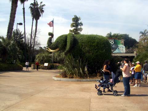
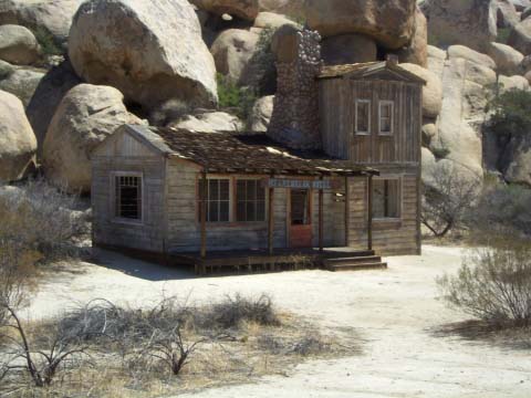
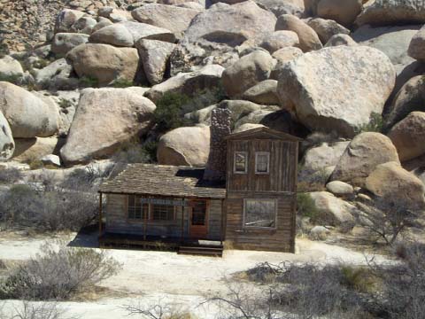
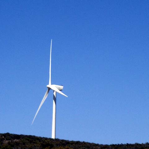
Archive for April, 2007

Pomona to Buellton, CA. 4-13-2007

Friday, April 13th, 2007

We didn’t rush to get up as we were in Pomona, CA.  No sense getting up early and get into the LA freeway rush hour.  We got on the road about 10 AM.  The wind was still blowing but not gusts of wind.  The lanes of the freeway looked just like Dallas or Houston freeway lanes, narrow.  They are narrow because they had 4 lanes once upon a time and changed them to 5 lanes without using any more land.  Even though Rick is used to driving our rig through Dallas we know which lane to be in to change freeways.  In LA we had to really pay attention to the signs plus pay attention to all the traffic and the wind. 

We drove down the San Bernardino, Ventura Freeway and the Pacific Coast Freeway.  We saw the Pacific Ocean.  We didn’t take a picture because our eyes were glued to the road.  Once we got above Santa Barbara the traffic eased up.  We went down some 6% and 7% grades.  We know what that means (straight down!!!!) and now we look to see the signs for how many miles we will be driving that grade.  We are relieved when we see only 1 or 2 miles rather than 12 miles.

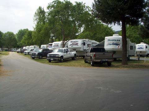
We arrived in Buellton around 2:30 PM.  We came here to attend a Montana (the make of our 5th wheel) Rally.  2/3rds of the people attending the rally were already in the RV park.  They were all standing around just watching all the Montanas drive in and park.

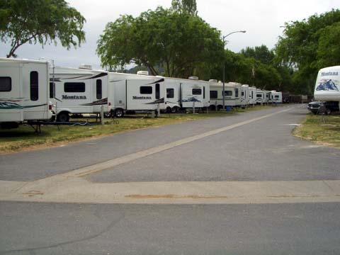
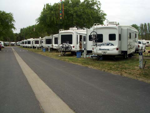
It is a very impressive sight to see 35 5th wheels parked together that look almost alike.  There were rows of them.  See if you can locate us.
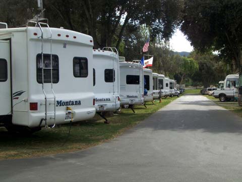
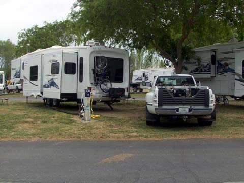
 a-montanas4.jpga-montanas3.jpga-montanas2.jpg

a-montanas1.jpg

Here we are—-

a-montanasus.jpg

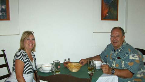
This rally is just a social get together of Montana owners and a chance to exchange information, modifications and ideas about Montanas.  There is a Montana forum on the internet so it is nice to put faces to some of the writers of the forum.

Are we in West Texas? Surely this can’t be Southern California!

Friday, April 13th, 2007

A low pressure system came in from the Pacific Ocean bringing 40 to 60 mile per hour winds, which brought a lot of swirling sand to all of southern California.  Rick white knuckled it down the mountain road that had signs everywhere reminding drivers of strong wind currents.  Yes, we could feel those strong wind currents as we made our way down to sea level.

Rather than going from San Diego to LA towing the 5th wheel on a crowded freeway with the winds blowing we opted to drive back to El Centro, through Palm Springs and then we spent the night in Pomoma near LA… 

What did we see on our trip?  Lots and lots of sand blowing in the air.  Reminded me of west Texas sandstorms.  The visibility in Palm Springs was about a quarter mile, and for brief moments, zero.  I am sure there was not any golf being played in Palm Springs the last 2 days.

The mountains near Pomona could only be seen through a haze of sand.

A few days ago we did a blog on windmills.  On the other side of Palm Springs we came across millions of them.  Okay, Okay, I exaggerate!!!!!  But there were thousands.

a-windmill.jpg

Then we came down the mountains into the LA area.  There was a steep grade of mountains but nothing like we had been through in the morning.

Tomorrow we are heading to the coast.  We will be in Buellton, CA, about 40 miles up the coast from Santa Barbara.  We hope the wind and sand has died down by then.

TECATE – A beer? No, a border town!

Wednesday, April 11th, 2007

We have been to several border towns in Mexico across from Texas.  As you go down the main street of any border town all the shopkeepers are trying to get the tourists to come in and buy their stuff.  You can not walk down the street without being bombarded with pleas from the owners. 

a-main-street-hill.jpg

 Yesterday we drove to Tecate, MX.  There is not a large CA population near the border town.  Tecate, CA is a very small town.  Usually we park on the US side and walk across the border.  Normally, there is a large paved organized parking lot.  Not in Tecate, CA.  The parking lot was not organized and it was not paved, but dirt.  We walked across the border and not one shopkeeper bothered us.  In fact most of them were in their shop.  Tecate, MX is not a tourist town.  It reminded us of a regular Mexican interior town.  We had a great lunch and then headed home.

a-lunch.jpg

There was a square with lots of people enjoying the day. 

a-square.jpg 

Mexican men meeting in the square playing dominoes.

a-dominos.jpg 

Mixed in with the local businesses were a few truly American sights, McDonalds and Domino’s Pizza.

a-pizza.jpg 

On our way back we came across an interesting sight.  In Texas we see wind generators on hillsides from a distance, such as in Big Spring.  In California, there are some that are fairly close to the freeway.  They look big, but their size, even close up is quite deceiving.   Each blade is 136 feet long.  This one is on Interstate 8 at the Tecate Divide, 50 miles east of San Diego.  You can find more information at http://www.signonsandiego.com/uniontrib/20050829/news_1m29wind.html.  

a-windmill-and-tower.jpg

The size of the  generator portion of the windmills are also deceiving.  Here’s one that is in transit on a huge semi-trailer

 a-widmill-on-truck.jpg Today we are getting our 5th wheel ready so that we can move on down the road tomorrow.  We are heading to Buellton, CA. which is 40 miles above Santa Barbara, CA.  It will take us 2 days to get there.  We are trying to only travel 200 miles at the most in any one day.

San Diego Zoo

Saturday, April 7th, 2007

We’re certainly glad that we decided to go to the San Diego Zoo on a weekday.  The place was jammed with people and what seemed like entire school districts. 

The zoo is well known for its animals, but their foliage is also amazing.  The entry to the zoo is guarded by a pair of large topiary elephants.

 a-entrance.jpg

From this aerial view (taken from the Skytram) you can see how green the place is. Note:  The large netting area is one of the many aviaries.

a-birds-eye-view.jpg 

To get acquainted with the layout of the zoo, we took a guided bus tour.  On that tour we learned that we needed to pay close attention to the “uphill” and “downhill” path designations on the zoo map. 

The koala exhibit had its share of cuteness.

a-koala.jpg

How about the world’s largest rodent.

a-snout.jpg

The elephants were playing with a large assortment of toys.  This one has a carrot filled ball that, when rolled drops a few treats.

a-carrots-in-a-box.jpg

For every animal that you recognize, there are ten that you didn’t know existed.  Here’s the blue crowned pigeon – yes pigeon.

a-blue-crested-pigeon.jpg

And the giant anteaters –

a-ant-eater.jpg

and a few more photos

a-black-and-white.jpg

a-bear.jpg

a-giraffe.jpg

a-rhino.jpg

And the oddest of them all —

a-skiway-tram.jpg

Desert Wonders

Wednesday, April 4th, 2007

On a recent journey out into the mountain desert area we came upon a number of interesting scenes.

We found an old movie set hotel that has been abandoned.  It was used in a TV pilot that didn’t make it.

a-movie-set.jpg

It is a full sized building, but is dwarfed by the huge rocks on the hillside.

a-movie-set-and-rocks.jpg

This is a fairly common sight, a mountain of huge boulders that appear to be put into place by a huge wheel barrow.

a-pile-of-rocks.jpg

This land, in the picture below, looks so much like Afghanistan that the military uses this area for training missions.

aafghanastan-look.jpg

There are many formations of rocks that appear to be balanced in a fashion that would seem to defy gravity.

a-rocks-balanced.jpg

a-rock-formation.jpg

a-rock-bird.jpg

We’ve seen many more examples and will add some new photos when we get some better shots.  Below is a little information on how the balanced rocks are formed.

a-history-of-rocks.jpg

Further information can be found at the source of this information: http://www.nbmg.unr.edu/staff/bell/documents/Bell%20et%20al%201998.pdf

We saw several old stagecoach trails weaving their way through the mountains.  They were quite narrow (5 to 8 feet) and looked very uncomfortable.  The old highway that was replaced by Interstate 8 was not much better.  As you can see by the two photos below, the road was very prone to rock slides.

a-rock-slides-on-old-highway.jpg

a-rock-slides-on-old-highway-2.jpg

One of the most amazing feats of construction was the railroad through the mountains.  The railroad trestels and tunnels were built by Chinese workers in the 1800’s.  The section in this area contains the longest trestle in the US. (not shown in photo) The tunnels are up to 7 miles long and were excavated with pickaxe and wheelbarrow. The photo below shows some of the trestles and I have marked a couple of the tunnels.

a-tressles-w-tunnels.jpg

Laziness and the stupidity of cows.  This photo shows what appears to be your standard cattle guard to prevent the movement of lifestock.

a-cattle-crossing.jpg

Guess what —  The cattle guard is actually painted stripes on the road.  Apparently it works.

a-cattle-crossing-2.jpg

Coming from, relatively flat, Texas, the visit to this area has been an extraordinary experience.