Archive for the ‘Texas Other’ Category

Fort Davis and the Davis Mountains

Sunday, August 15th, 2010

Click for Fort Davis, Texas Forecast

Tinka’s been trying to get Rick to the Davis Mountains ever since their marriage.  Her first visit to the area was when she was an infant, many years ago.  Her family would come here every year for vacation. More about that later.

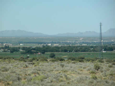
Rick, a confirmed flat lander, has resisted until now.  Since we were going to be traveling back to the Rio Grande Valley from El Paso on I-10, our path carried us too close to the mountain range for any excuses to work.  As we traveled east from El Paso, farmland and the Rio Grande, marked by the row of trees, were just south of us.  The mountains beyond the river are in Mexico and seem to be endless.
rio-grande.jpg

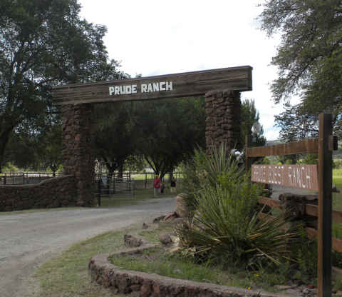
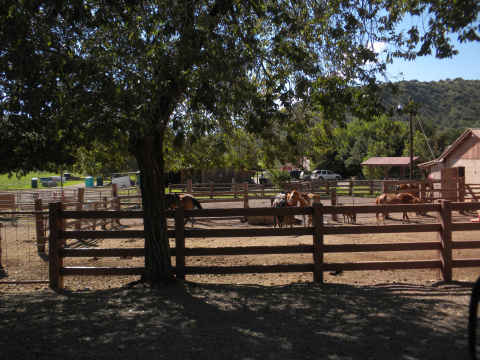
When we travel, the discount RV park directory from Passport-America is our choice.  When checking out the Fort Davis area, we came across the Historic Prude Ranch.  The ranch is a dude ranch tailored to more youthful guests than us.  They have two areas for RVs.  We chose the one located on an upper level of the grounds, farthest from the farm animals and their flies.
prude-ranch-gate.jpg

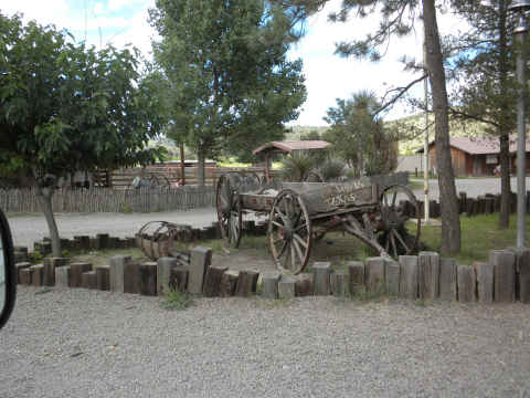
We were only going to be here three nights, so we didn’t get a chance to use many of their facilities.
prude-ranch-1.jpg

prude-horses.jpg

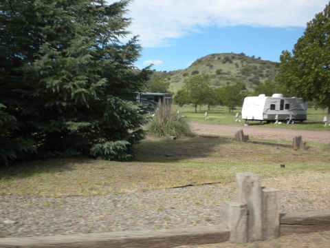
Here’s one of the other rigs that happened to stop by at the ranch.
prude-ranch-trailer.jpg

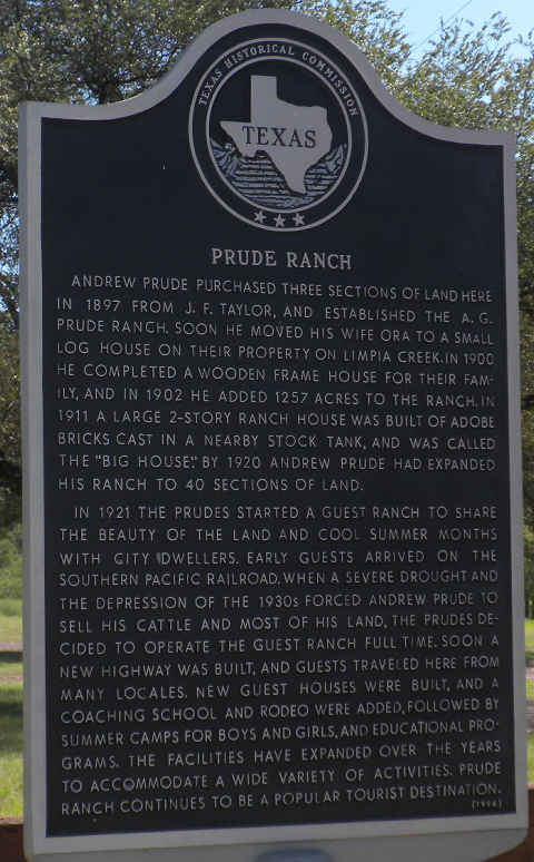
The Prude Ranch has been in business for 113 years  and they have operated the dude ranch for about 90 years.
prude-ranch-hist-mark.jpg

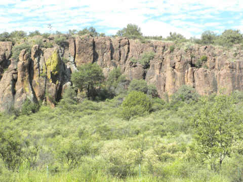
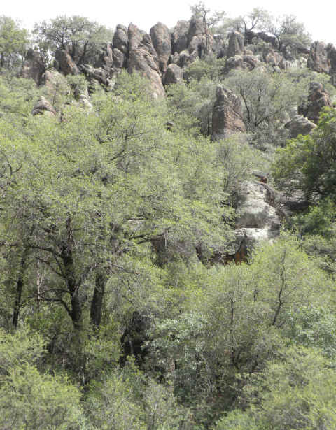
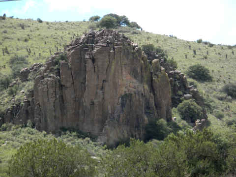
Finally, Rick finds a mountain range that he likes.  The Davis Mountains are entirely within the borders of the state of Texas.  They were formed from volcanic action that centered close to nearby Marfa, TX nearly 65 million years ago.   The rock formations and effects of erosion are magnificent. This particular rock is located near The Lodge at the Davis Mountain State Park.

dm-rock-480.jpg

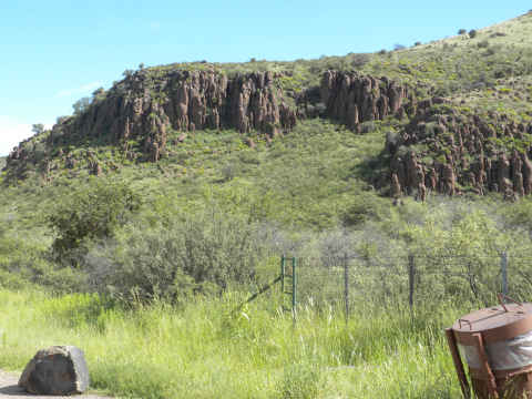
The unusual vertical rock formations are everywhere.
dm-rocks.jpg

The ridges stretch for miles.

dm-rocks2.jpg

dm-rocks3.jpg

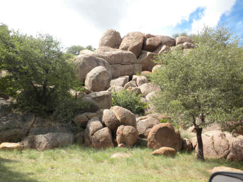
Other rock formations are similar to what we saw in the southern California mountains and the “Texas Canyon”, located just east of Tucson, AZ.
dm-round-rocks.jpg

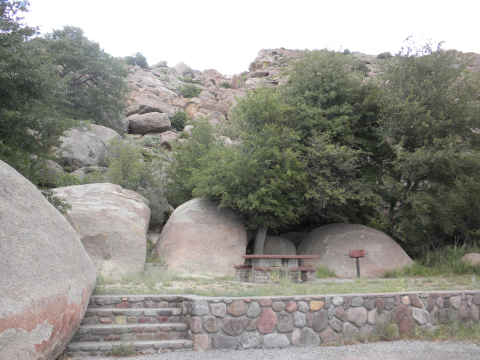
Picnic areas, here, are integrated very well into the rough background.
dm-rocks-table.jpg

From 1850 until 1875, the town of Fort Davis was the original county seat for Presido County, home of the oldest town in America, Presido.  (Presidio has been continuously inhabited since about 1500 BC.)

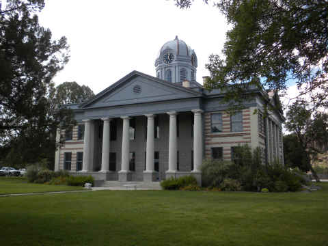
But I digress, the counties were reconfigured and Fort Davis is now the county seat of Jefferson Davis County.  The county courthouse has been maintained beautifully, with some newer facades.
courthouse-fort-davis.jpg

The entire county has only a about 2500 people.  One of them is a night police officer that thinks that 3 miles per hour over the posted limit is actually speeding.

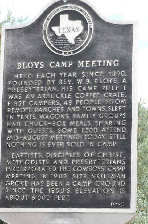
Now, back to Tinka’s early vacations.  Since before Tinka was born, her parents, aunts, uncles, and cousins would find their way to the Davis Mountains for a week each August.  Their destination was the Bloys Camp Meeting where four protestant  church denominations have been holding these gatherings since 1890.
bloys-camp-meeting-hist-sign.jpg

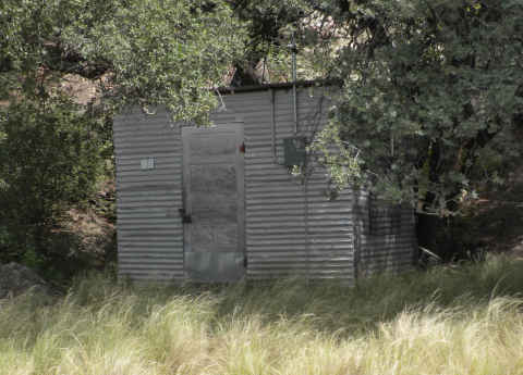
Apparently, the original visitors to Bloys used to stay in tents or other temporary structure.  Some sixty years ago, Tinka’s father decided to build a cabin constructed from corrugated tin.  Nestled back against the boulders, it became Cabin No. 1.
cabin-1.jpg

Now there are about 450 cabins, still nearly all made of tin, but many have satellite TV.  They seem a little extravagant for only one week per year.   Permanent residence is not allowed.

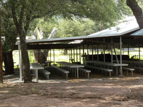
Here is one of several cooking sheds that service the huge crowd.
dining-hall.jpg

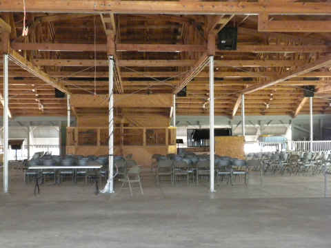
This tabernacle houses the four daily worship services.
tabernacle.jpg

A monument has been erected to honor the memory of one of the founders of the Bloys Camp Meeting.

We’ll be making trips to the McDonald Observatory and also see if we can spot the mysterious Marfa Lights.

Back to Texas

Saturday, August 7th, 2010

Click for El Paso, Texas Forecast

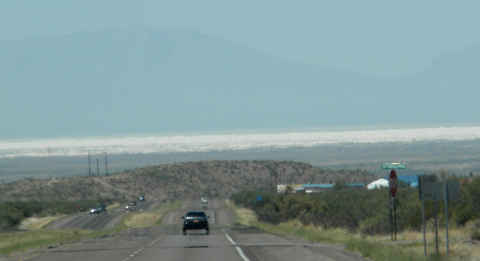
Well, time came to swap one mountain range for another.  As we left Ruidoso, NM and headed past Mescalero to Alamogordo, we spotted what looked like low hanging clouds.   (Click on photo to enlarge)

1a-white-sands-480.jpg

It turns out that these are not clouds, but the White Sands Missile Monument, home to the White Sands Missile Range.

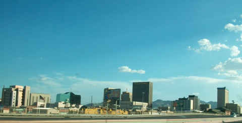
Only about 3 hours from Ruidoso is our next stop, El Paso, TX.  We’re here to spend a few days to catch up with Tinka’s lifelong friend, Sherri. The downtown area looks good with a sky that is this blue almost every day.

1a-downtown.jpg

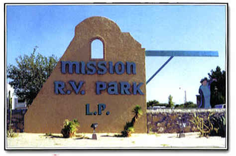
As we usually do, we set up at the Mission RV Park.  Usually the park is packed, but this time it was less than 50% full.   The park is very well equipped.  We used Passport-America discount.

1a-mission-rv.jpg

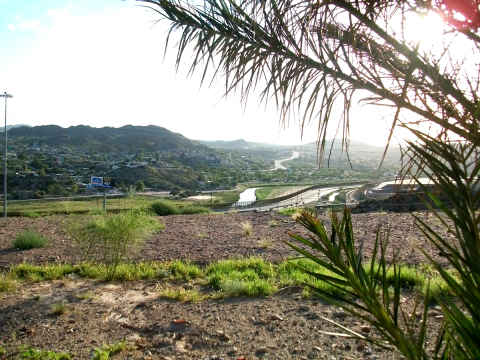
We headed over to the western portion of El Paso where we were able to catch an afternoon view of the Rio Grande and I-10 as it heads into New Mexico. (Click on Photo to Enlarge)

1a-river480.jpg

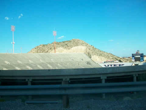
Here’s a peek into UTEP’s Sun Bowl.

1a-sun-bowl.jpg

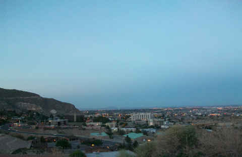
On the way back to the RV park, we had the opportunity to take this evening shot of El Paso and its much larger neighbor, Ciudad Juárez, Mexico, in the distance.

1a-night-shot-480.jpg

We had a nice visit with Sherri and had the opportunity to see how grown up her granddaughters are getting.

1a-pool.jpg

We are leaving here to spend a few days in our next mountain range, the Davis Mountains of West Texas.

The New “Oil Wells”

Friday, July 23rd, 2010

Click for Sweetwater, Texas Forecast

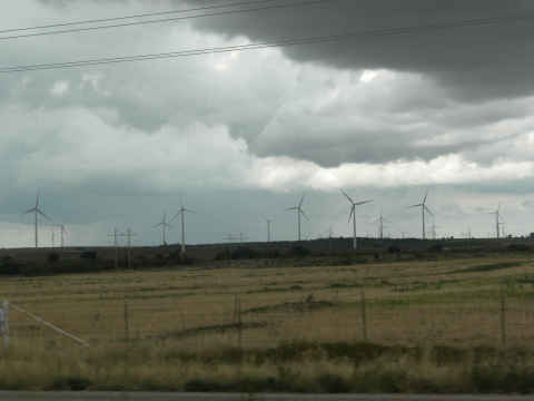
As you might imagine, while driving west from the Dallas/Fort Worth area we’re used to seeing oil well after oil well.  Oh yes, they are still there and pumping like crazy.  But, the population of the “new oil well” is growing dramatically.  Of course the “new oil wells” are actually windmills.

c-windmills.jpg

We knew that it was always important to never sell your mineral rights.  Apparently that goes for surface rights too.

Time On Your Hands?

Wednesday, May 19th, 2010

Have you ever been driving along the highway and spotted 5th wheels or trailers stationed along the road at various ranch entrances?   These gates are, generally, access points for oil and gas drilling activity.

Well, we went to visit some friends that agreed to monitor activity at one of these gates for 30 days.  This particular gate was quite active.  They noticed a slight down time in activity between midnight and 3:00 AM each morning.  But, in essence, it was a 24/7 activity.

Unless they were outside, the gate must remain closed.  Sensors advised them when a vehicle approached the gate from either direction. The coming and going of each vehicle needed to be logged and signatures collected upon entry to the property.

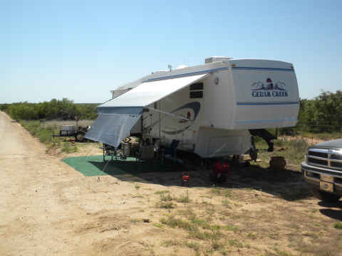
gate1.jpg

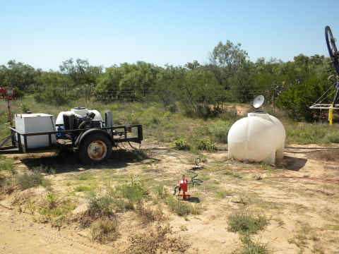
The typical set up includes electricity, provided by a diesel generator with about 10-day supply of fuel, and an ample supply of water. Gray water is discharged and the black tanks are serviced every 10 days.

gate2.jpg

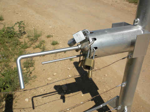
Now, whoever developed the design of this gate lock had entirely too much time on his hands.

gate3.jpg

In order to allow multiple land owners or other people access to the land, there are holes for eight different locks on the latch mechanism.  By removing one of the locks, a hole is vacant in the end of the device.  Rotating the bent handle until the straight bar lines up with the empty hole, allows you to pull the handle out with the bar passing through the hole, thus disengaging the gate.  Quite ingenious.

Potty Break

Sunday, May 16th, 2010

Click for Laredo, Texas Forecast

In keeping with our fascination with Texas rest areas, we’ve come across one that has more fashion than function.

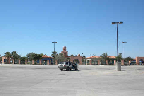
Located just north of Laredo, Texas, this “rest area / information stop” was built eight years ago.  They must be expecting large crowds, because this parking lot is enormous.

rest-stop1.jpg

Why that car decided to park in the fourth row is still a mystery.

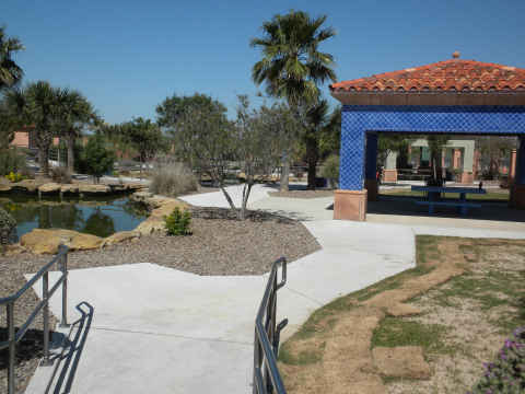
The layout of the “park” is gorgeous.

rest-stop2.jpg

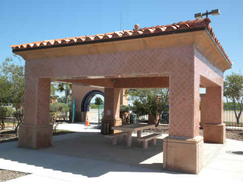
Each picnic table area is covered in a fashion that anyone would like in their back yard.  (Note the tile work.)

rest-stop5.jpg

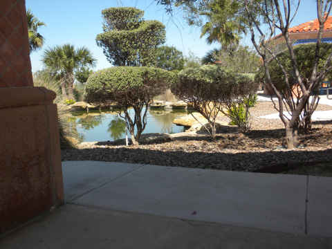
Care is taken to sculpt the shrubs.  (Your tax dollars at work)

rest-stop6.jpg

The information center and bathrooms are located in this facility.  It is an extraordinarily long distance from the parking lot.  This would be quite a hike for anyone having difficulty walking.

We commented to the info-center attendant that it is a long way for handicapped folks to travel.  Her comment was, “Oh, there are handicapped facilities on the other side of the parking lot.”

Remember that huge parking lot.  Well, look what we found on the far side.

rest-stop7.jpg

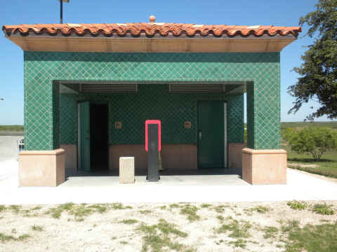
Yep, the handicapped bathrooms.  No signs divulged its location.

For you bathroom aficionados,  we’ll keep you posted on interesting stops along the road.